Grand Canyon National Park
America’s most famous national park and natural formation, the Grand Canyon, of northern Arizona is a staggering 277 miles long, up to 18 miles (29 km) wide, and attains a depth of over a mile (6,093 feet or 1,857 meters). The canyon, which was carved by the Colorado River over the last 70 million years as the Colorado Plateau was uplifted, exposes 40 major sedimentary rock layers, ranging in age from about 200 million to nearly 2 billion years old. Most were deposited by ancient shallow seas that stretched across North America. For all its majesty, the canyon’s sheer size makes it difficult to photograph though watching both sunrise and sunset at its edge is always a magical experience.


Coal Mine Canyon & Ha Ho No Geh Canyon
These hidden gems located in the Hopi Reservation of northern Arizona may lack the breadth, depth, and age of the more famous Grand Canyon to the west but Coal Mine Canyon and Ha Ho No Geh Canyon are more colorful, diverse, and hardly visited by tourists.
The compositions one can shoot of these twin canyons are endless and the colors, forms, and textures of the eroded sandstone rival that of Monument Valley and Canyon de Chelly to the east. Only a few solitary dirt roads lead to certain sections of these canyons but once there, visitors are free to roam endlessly looking for interesting vistas. Because of their remoteness, the canyons are criminally overlooked but the fact that photographers can shoot either from the west or east makes them perfect for both sunrise and sunset photography.


Lost Dutchman State Park
Located 40 miles east of Phoenix in the Sonoran Desert, Lost Dutchman State Park and nearby Tonto National Forest are home to wonderful variety of cacti, shrubs, and other desert plants. The main attraction, however, are the Superstition Mountains, a stunning range rising from flat land. The peaks reach a maximum elevation of 6,266 ft (1,910 m) and prominence of 1,706 ft (520 m). Their height, along with the rich flora at their base allow for quintessential Southwest desert photos.
"The Superstitions" also hold local folklore significance as some Apaches believed that the hole leading down from within them enters the lower world, or hell. Today it is thought that the winds blowing from this hole create the severe dust storms metropolitan Phoenix experiences regularly.

Blue Canyon
One of Arizona’s best kept secrets is an incredibly scenic section of the Hopi Reservation’s Moenkopi Wash filled with multicolored rocks and interesting formations. The area can only be legally accessed with a permit from the Hopi Nation and a guide. The rocks there have eroded and broken down into countless smaller pieces and this erosion has opened up small slot canyons and side trails.
Most of the rocks in the canyon have splashes of white streaked across them and look like Native American petroglyphs (images created by removing part of a rock surface by incising, picking, carving, or abrading, as a form of rock art). These streaks really draw the eye (and the camera). It’s hard to believe that natural processes create such human-like decorations but such is the beauty of Blue Canyon.


Little Colorado River Gorge
The Little Colorado River is a tributary of the Colorado River that carved the Grand Canyon over millions of years. Views into the Little Colorado are quite grand and sweeping as it is one of the largest arms of the Grand Canyon. Early Native Americans settled along the river and have continuously inhabited it for thousands of years, giving it its original name, “Paayu.”
The gorge, pictured here, is a section of the Little Colorado River, making up the lower 57.2 miles (92.1 km). There are a number of overlooks off of Highway 64 (Desert View Drive) accessed - for the most part - for free.

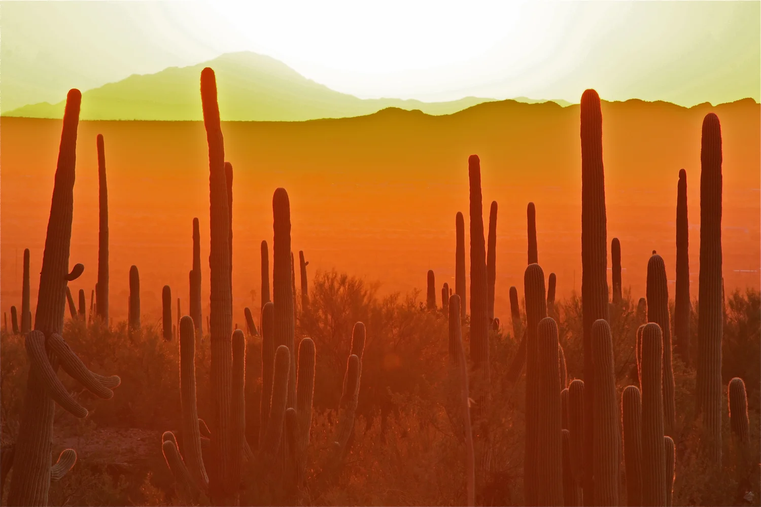
Saguaro National Park
Saguaro National Park is home to one of the greatest concentration of the Southwest’s most recognizable and iconic plant, the giant saguaro cacti. The plant is closely associated with western films and a symbol of the Southwest in general. Located both east and west of Tucson, the cacti in the national park grow twice as fast as those in western Arizona’s because of the region’s precipitation rates. It’s astonishing how wide and tall they can grow – occasionally over 40 feet (12.2 metres) in height!
Sweeping views of saguaro forests are best observed on the Cactus Forest Drive in Saguaro East – Rincon Mountain District and the Scenic Bajada Loop Drive in Saguaro West – Tucson Mountain District. The saguaros silhouette very well during the warm sunsets typical of southern Arizona, especially when the air is a bit hazy and/or clouds are present.
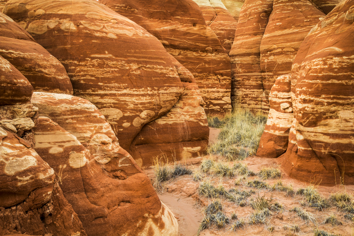
White Pocket (Vermilion Cliffs National Monument)
Few places are revered by well-traveled Southwest photographers as much as White Pocket in Vermilion Cliffs National Monument. The approach to this location is bumpy, confusing, and very sandy rendering it accessible to only the few and devoted. But the otherworldly formations and colors found here are absolutely mind-blowing.
There are no formal trails around White Pocket so visitors are free to find their own way around the small area. Many of the most compelling compositions include “brainrock” - rock surfaces that have eroded cracks and lines on their surface.
The Southwest is littered with areas that can be considered “alien” but this place takes it to another level. You could spend a week in this small area and continue to find new photographic compositions.


Cottonwood Cove (Vermilion Cliffs National Monument)
Cottonwood Cove is located near White Pocket in the South Coyote Buttes area of Vermilion Cliffs National Monument and similar in look to White Pocket’s rocks, cones, and surreal formations. As a reward for the backcountry navigation and driving skills that it takes to get there, visitors encounter amazing one-of-a-kind desert scenery. I particularly liked the pictured set of rocks that share the same swirls of colors - yellows, oranges, browns, and reds.


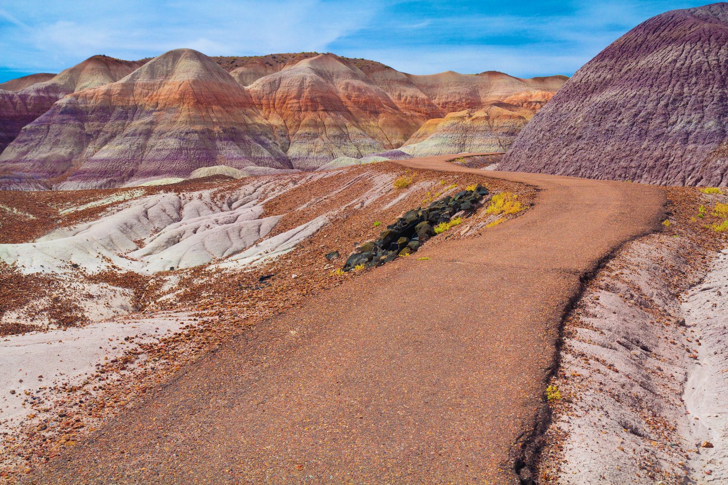
Petrified Forest National Park
As its name suggested, Petrified Forest NP preserves a 200 million year-old forest of confer trees that lived in the Late Triassic Period. During this period many trees were downed due to shifting streams and began accumulating in river channels. As they were quickly buried by the sediment, groundwater carried dissolved silica (silicon dioxide) it into the logs, where it formed quartz crystals. These crystals gradually replaced the organic matter forming what we see today.
Although the logs are an incredible sight, the park’s badlands are perhaps most extraordinary. The short one-mile Blue Mesa Trail, in particular, weaves around fragile bentonite clay and petrified wood exposing a kaleidoscope of wonderful colors. This trail, and much of the park, is part of the multicolored “Painted Desert” of northeastern Arizona.