
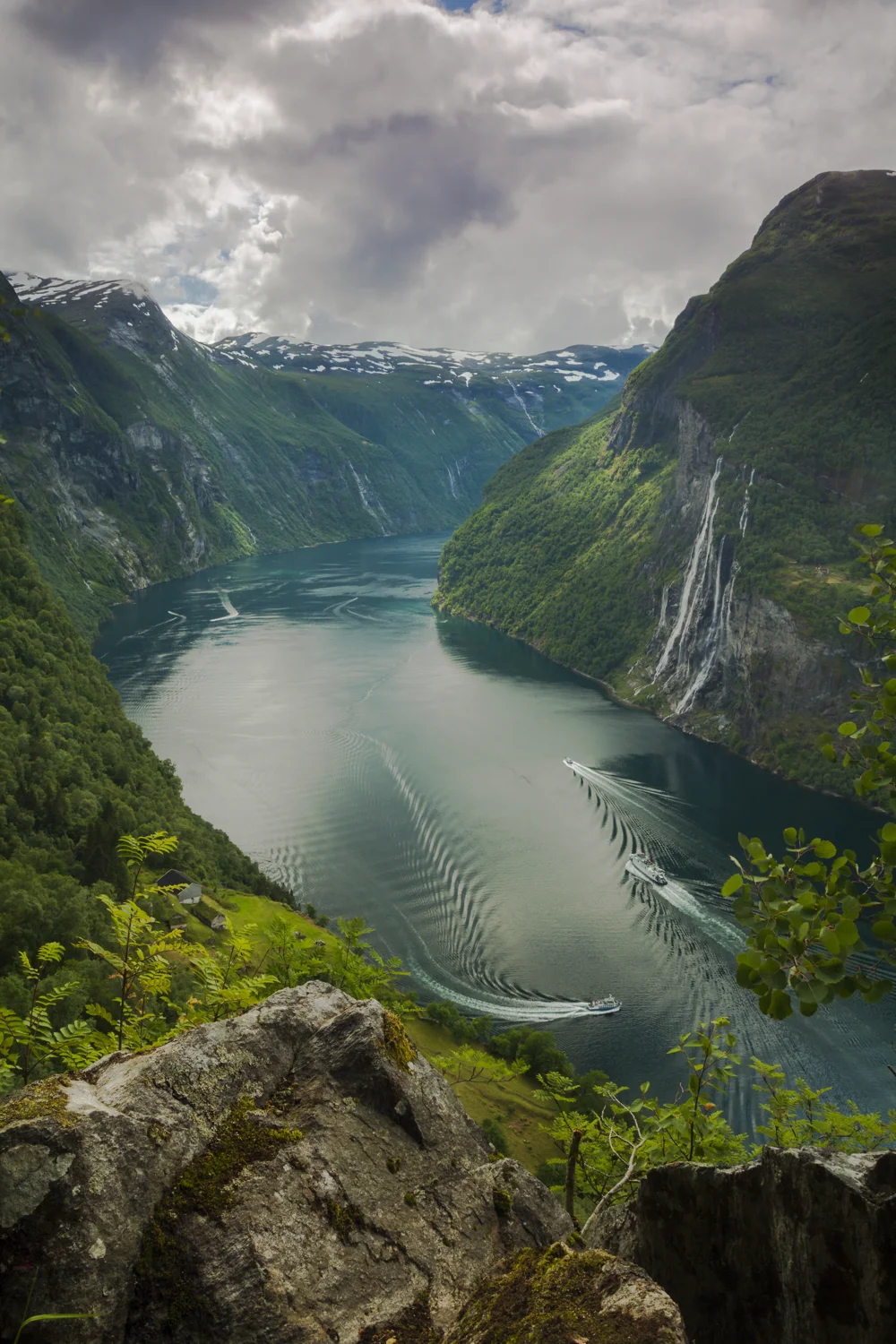
Geirangerfjord
The western region of Norway is dotted with hundreds of fjords—canyon-like formations created by advancing and retreating glaciers during the last few ice ages. One of Norway’s most visited and famous fjords is Geirangerfjord, an absolute paradise for landscape photographers. For scale, note the boat in the foreground of the second picture, which is about to make a leftward turn into the heart of the fjord. This fjord is surrounded by some of the steepest mountains on the entire west coast. It is very narrow and has no habitable shore area because the mountains rise sharply and almost straight out of the water. Several beautiful waterfalls plunge into the fjord from jagged peaks above.

Geirangerfjord
Geirangerfjord

Geirangerfjord

Geirangerfjord
Along the fjord's upper terraces lie a number of abandoned farms, whose history serves as a great introduction to Norway’s agrarian past. These mountain farms are accessed by steep paths and often hazardous cliff-side trails. Early residents also anchored bridges to the mountains with iron bolts and rings to ease access. As Magdalene Thoresen, mother-in-law of Norway’s most famous author Henrik Ibsen, said of them, “They bear witness, in a most striking way, to the remarkable powers of invention which the challenges of nature have developed in man.”
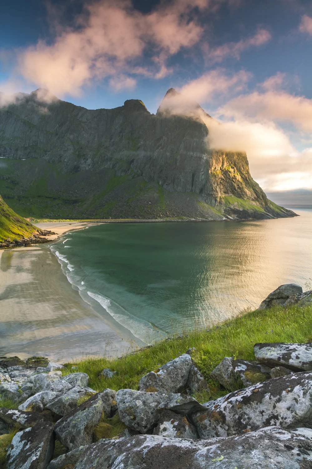
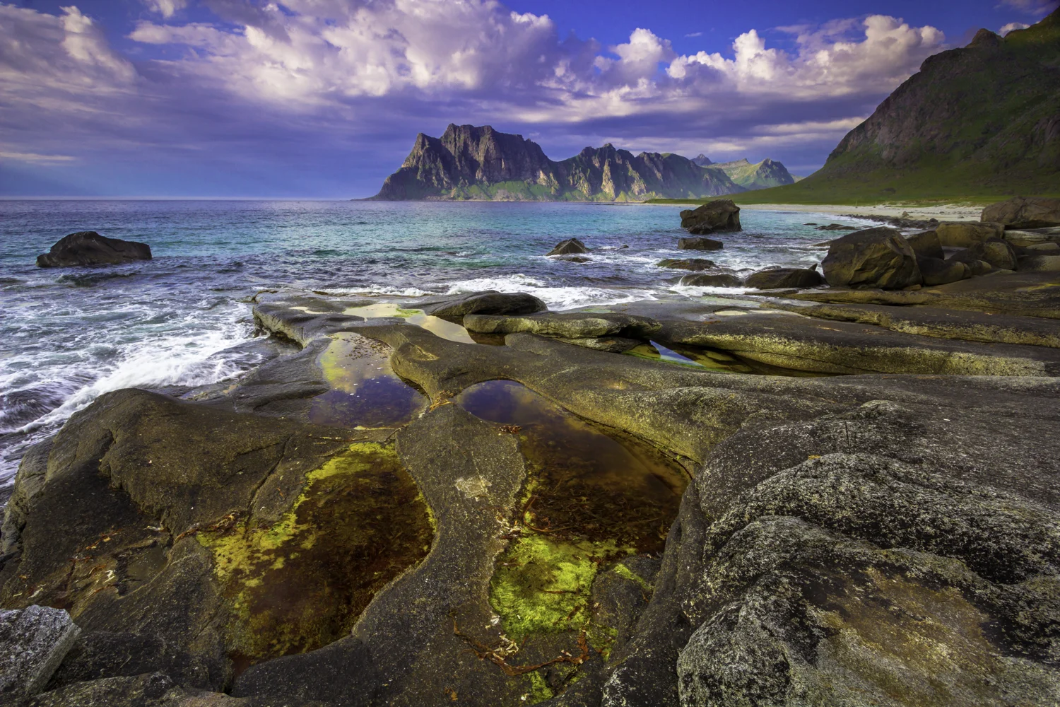
Lofoten Islands
The Lofoten Islands, located north of the Arctic Circle in Norway, are among the most stunning landscapes I have ever seen. Towering mountain islands rise steeply from the ocean, occasionally interrupted by white sandy beaches at their base. One of the best views of the surrounding Lofoten peaks can be enjoyed after a challenging but rewarding hike up Reinebringen, an ideal spot to camp and capture both sunset and sunrise. You can see the impressive scale of the peaks and fjord compared to the town of Reine in the bottom-right corner of the picture. The nearby Vaeroy Island is also a beautiful island paradise, accessible only via ferry across the Arctic waters.

Reinebringen

Vaeroy Island
The islands are known for their pristine and wild beaches, many of which are only accessed by hiking in and camping overnight. Pictured here is Kvalvika Beach, Uttakleiv Beach, and Horseid Beach. Each beach is typically surrounded by a series of cliffs that add a particular sense of remoteness to the experience.

Kvalvika Beach
Horseid Beach
Uttakleiv Beach

Horseid Beach
Trollveggen & Romsdalen Valley
Romsdalen is a valley in Norway with towering peaks on both sides, including Trollveggen, or “the Troll Wall.” Trollveggen is part of the Trolltinden massif and is one of the most impressive vertical cliffs in Norway. I can’t even begin to describe how wide, vertical, and immense this rock wall is. I highly recommend camping overnight across the Romsdalen valley to witness the mountains glowing during sunset and sunrise.
Leading in and out of the valley is the serpentine “Trollstigen” mountain road, which winds up the mountainside at a steep incline of 10%. The viewpoint at the top offers a fantastic view of the serpentine route below to the left.

Trollveggen and the Romsdalen Valley

Romsdalen Valley area

Trollstigen
Central Norway Fjords
The following photographs are from the heart of Norway’s fjord region, which is home to some of the largest and deepest fjords in the world, including Sognefjord, nicknamed the King of the Fjords. Sognefjord and the nearby Hardangerfjord are so vast that several side-fjords branch out from them, such as Eidfjord and Aurlandsfjord. The area is also known for one of Norway’s most famous fjord hikes, Besseggen Ridge, a mountain trail that offers views of lakes on both sides. Additionally, the region boasts stunning lakes like Lake Oldevatnet and waterfalls, including Vøringfossen, which are fed by the movement of water along these fjords.

Eidfjord

Besseggen Ridge

Lake Oldevatnet

Aurlandsfjord


Vøringfossen
Lysefjord and the South
Southern Norway is home to the famous Lysefjord and two renowned hikes: Kjeragbolten and Preikestolen, also known as “Pulpit Rock.” While the near-constant rain prevented me from photographing Preikestolen, both it and Kjeragbolten offered spectacular views. I did manage to capture the sunset illuminating the impressive thousand-meter walls of Lysefjorden through the fog from the shores of Lysebotn, the lake below.
The area is also known for its beautifully situated abandoned fjord mountain farms scattered throughout the countryside.

Preikestolen

Lysefjord
