
Los Flamencos National Reserve
Los Flamencos is a large protected area that houses a rich diversity of plants and animals in the middle of the Atacama Desert. Consisting of seven separate regions, each with different flora and fauna, it is perhaps the centerpiece of this arid desert and my favorite section of northern Chile. Ancient and extinct volcanoes dominate the landscape, particularly Miscanti and Miñiques, both of which rise over colorful altiplanic lagoons. However, what sets this place apart is the surreal colors of the land. At Salar Aguas Calientes, I encountered turquoise water and "piedras rojas" (red rocks) at the base of large mountains, and at Bofedal de Quepiaco, I photographed yellow-colored vegetation and algae mixed with deep red soil.

Laguna Miscanti

Laguna Miñiques
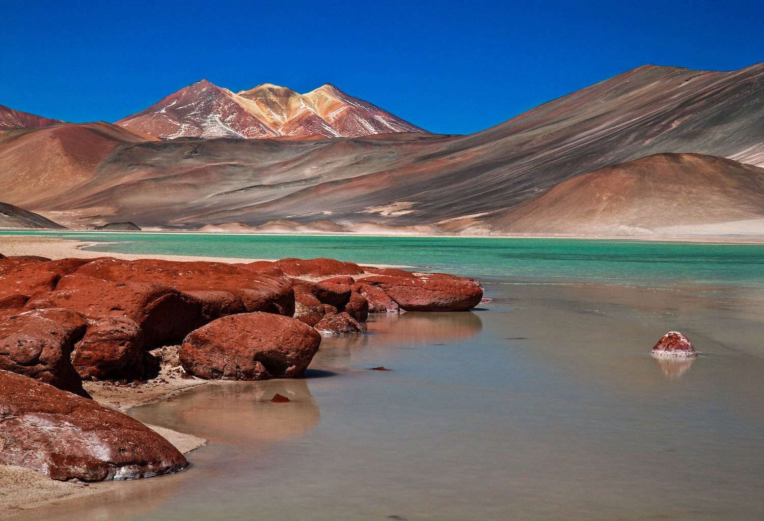
Salar Aguas Calientes

Bofedal de Quepiaco
Valle de la Luna (Valley of the Moon)
The reserve is also home to Chile’s Valle de la Luna (Valley of the Moon), a beautiful area of eroded badlands shaped by wind and, occasionally, water. The rocks feature an impressive range of color and texture, but the most amazing part is the abundance of salt on the ground. Wide areas of white salt cover the red rock (picture five), creating a striking contrast with the dirt.
As the sun set, the soft light brightened the reds, browns, and salt whites of this surreal landscape. You can see the last light hit the background peaks, including a volcano in the upper right-hand corner.

Salar de Atacama
The Salar de Atacama is the largest salt flat in Chile and the third largest in the world, offering plenty of room to scout foreground elements against the backdrop of distant volcanoes. My favorite section, Laguna Cejar, is a sinkhole that has collected water over time despite the aridity of the Atacama Desert. The salt concentration ranges from 5 to 28% (50 to 280 parts per thousand), creating buoyancy at the higher end of the range similar to that of the Dead Sea. Tourists come here to float in the water, but I was too enthralled with photographing the place to join them.

Laguna Cejar

Laguna Cejar

Atacama-Altiplano border
There are so many volcanoes to be found in the region where the Atacama Desert in Chile meets the Altiplano in Bolivia. Giants like Parinacota remain snow-capped year-round due to the extreme elevation and stable, cold temperatures. The beautiful mountain overlooks the muddy wetlands of Lago Chungará. Parinacota’s twin, Pomerape, is referred to together as the “Nevados de Payachatas” and serves as the centerpiece of Lauca National Park in Chile and Sajama National Park in Bolivia. Both can be seen behind the llama in the second photograph.

Lago Chungara and Volcan Parinacota

El Tatio Geyser Field
The famous El Tatio Geyser Field is also located near the border on the Chilean side and is the third largest geyser field in the world. Situated 4,320 meters above sea level, it is a cold, surreal, and eerie place in the winter.
A group of tourists and I left our hotels in the middle of the night to arrive here by sunrise, when the steam condenses in the frigid air. I found it challenging to find an angle that was both filled with plumes and free of tourists. Fortunately, I stumbled upon this view just as the sun started to come up and took photographs.

Bolivian Altiplano
The Altiplano in Bolivia is a dreamlike place of rolling mountains, colorful lakes and ponds, bizarre flora, and serene isolation. Notably, Laguna Hedionda and Laguna Colorado are both high-altitude lakes where bright yellow shrubs and ferns grow on the banks and flamingos feed in the multicolored waters. Beyond each lake are mountains and volcanoes of various sizes and elevations. Bolivia’s most famous natural landmark, the Salar de Uyuni, is the largest salt flat on Earth, and driving across its perfectly flat surface without any visual reference points disorients and obscures one’s sense of distance. Like Chile’s Atacama Desert, Bolivia has its own geothermal region, the Sol de Mañana geysers, and, like El Tatio, the light is best right at sunrise.

Laguna Hedionda

Laguna Colorado


Salar de Uyuni

Sol de Mañana Geysers