
Nunavut
Auyuittuq National Park (Baffin Island)
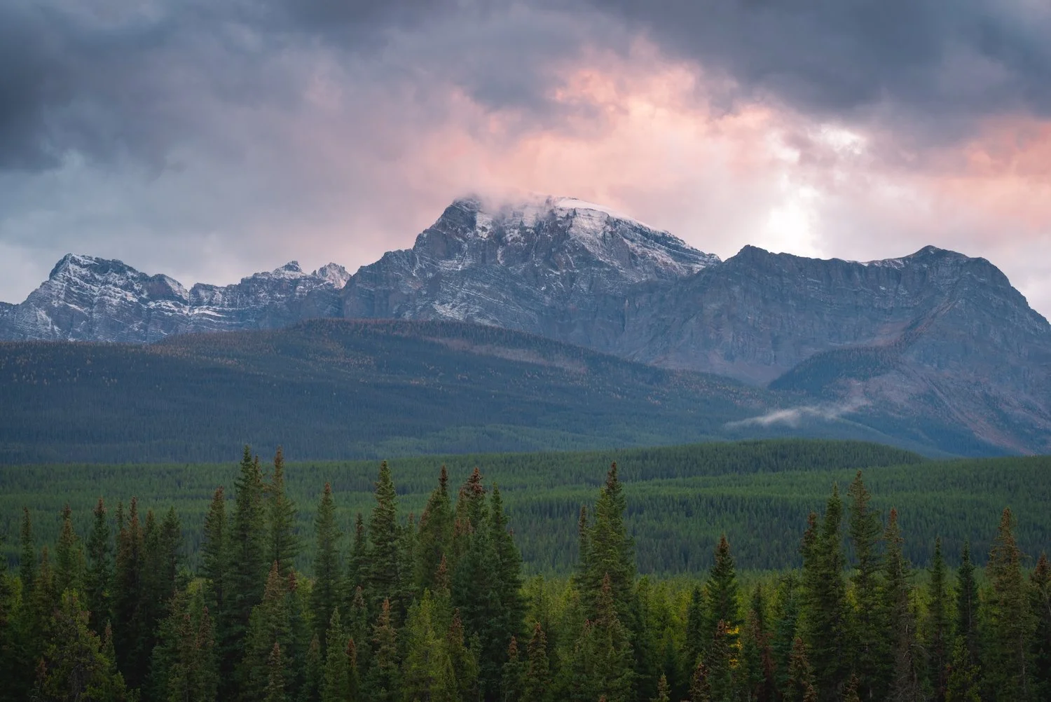
The Canadian Arctic is truly one of the last remaining regions of wilderness on the planet. Its harsh climate and inaccessibility have left a majority of this vast land unoccupied and unexplored. Baffin Island, in the northern territory of Nunavut, with its jagged mountains, enormous glaciers, untamed rivers, and expansive ice sheets, is a particularly notable highlight of the region. Baffin is the fifth-largest island in the world and contains Auyuittuq National Park, renowned worldwide by climbers for its vertical granite towers and mammoth glaciers.

Akshayuk Pass


Mount Odin
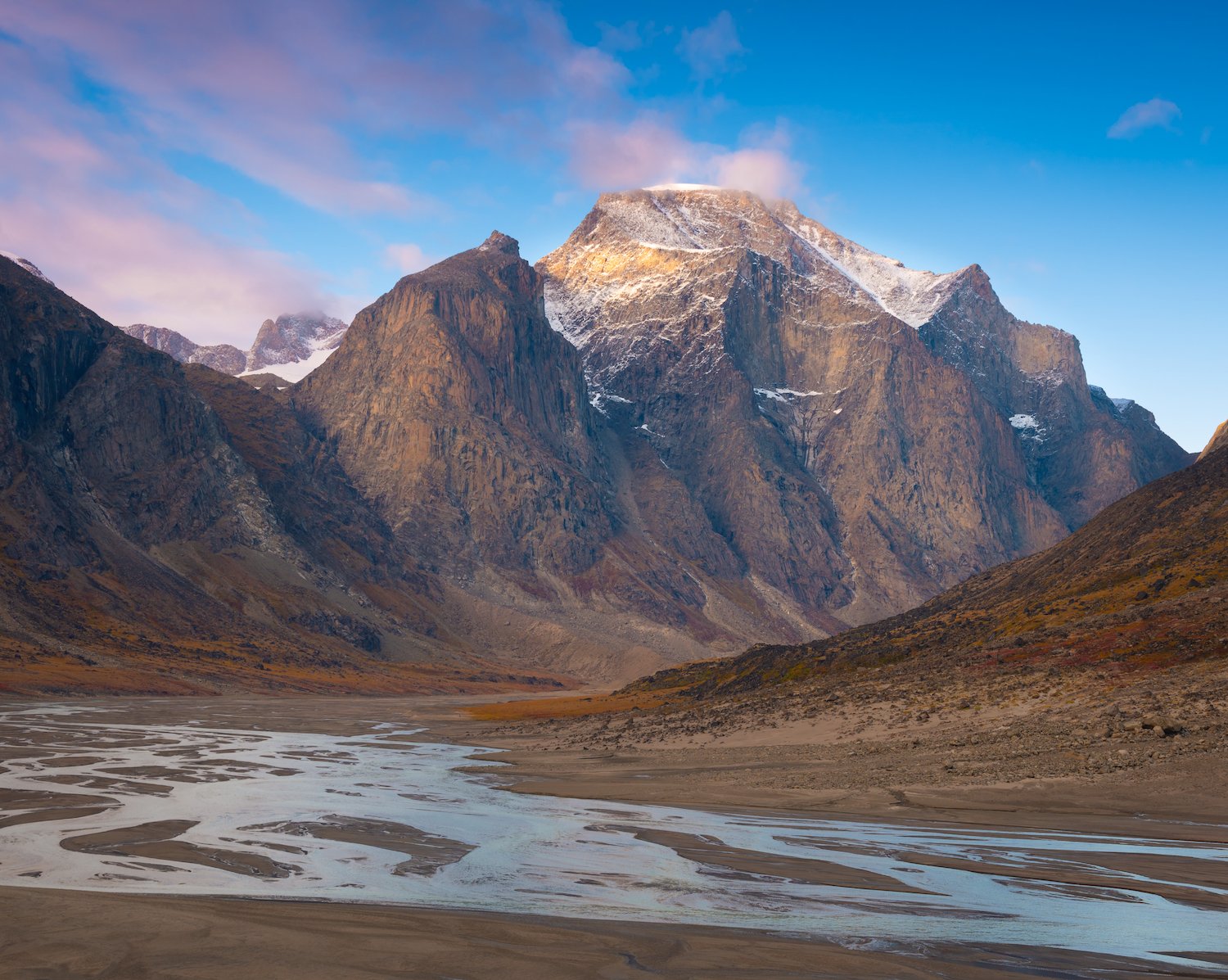
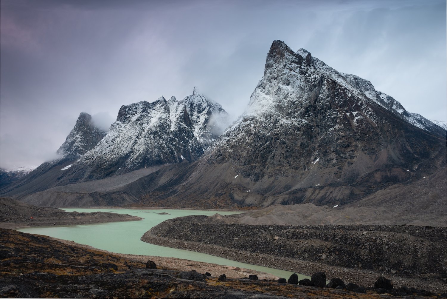
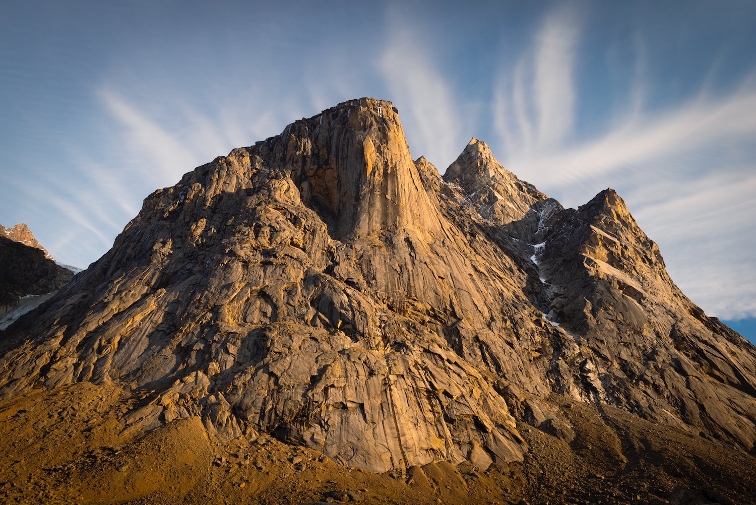
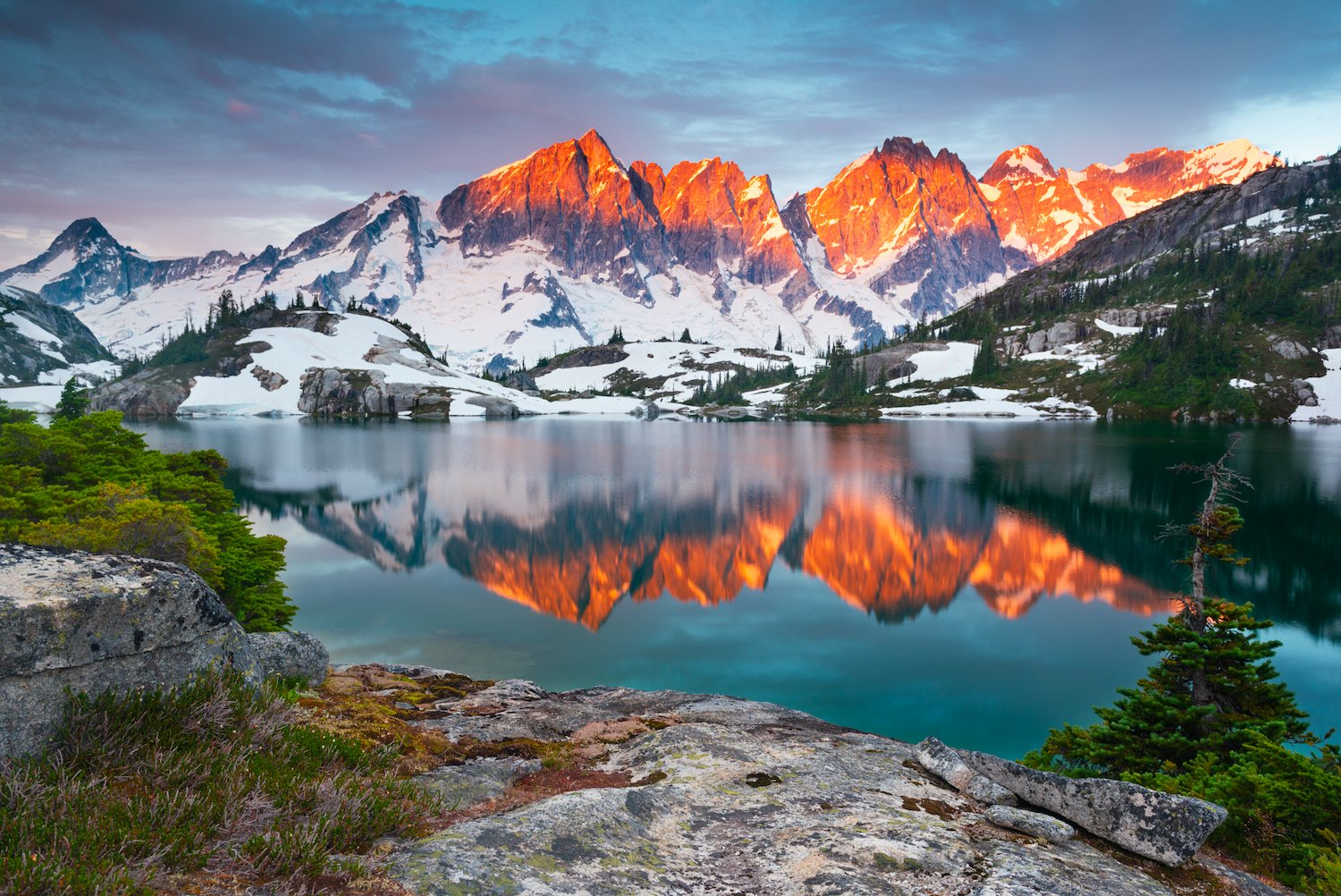
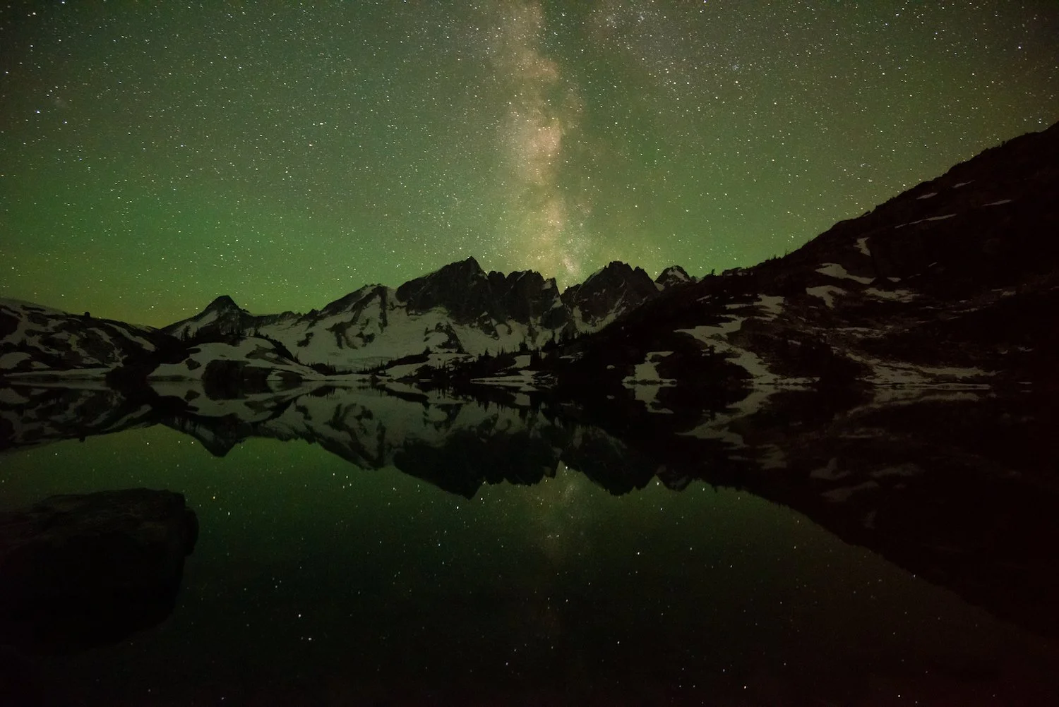
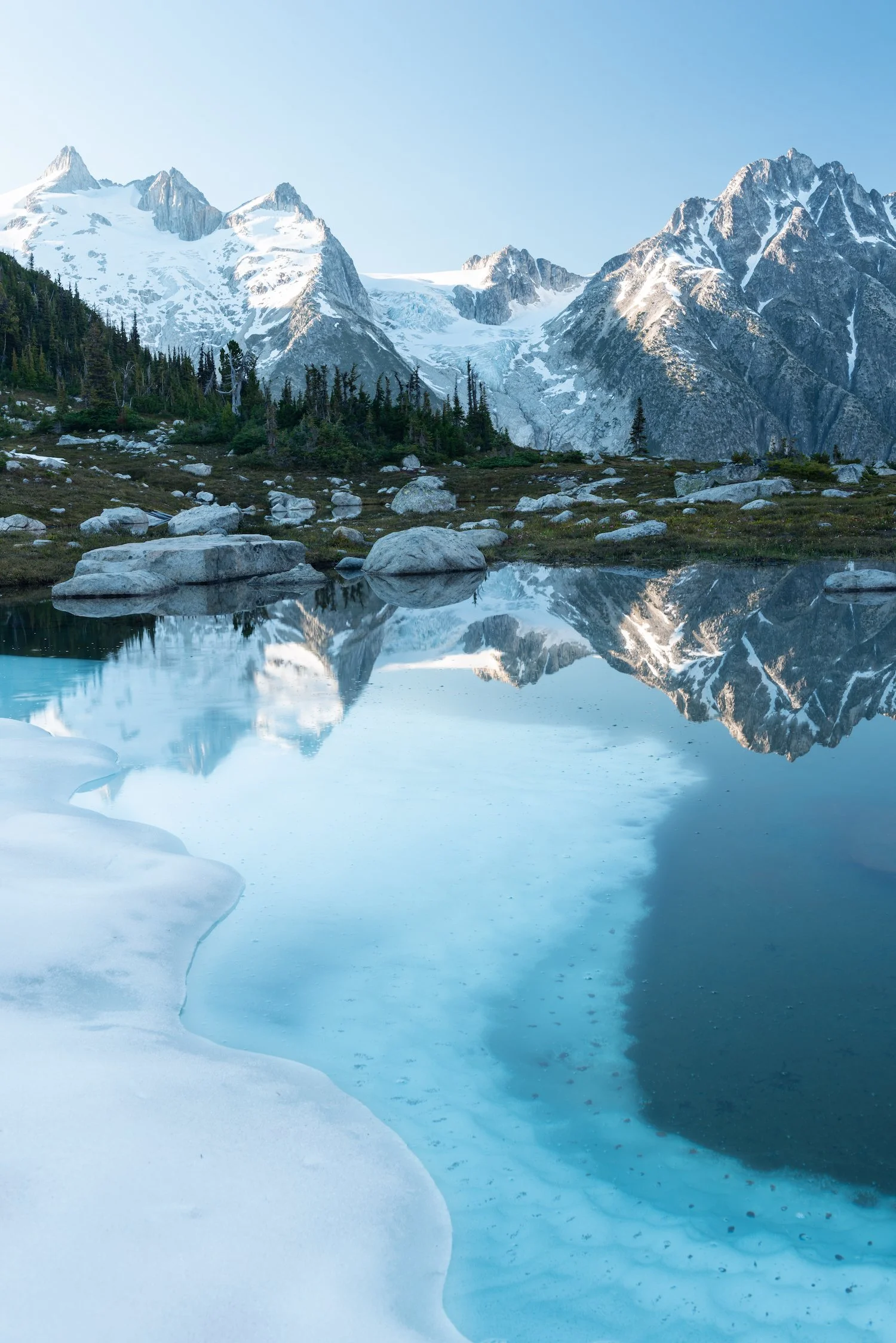
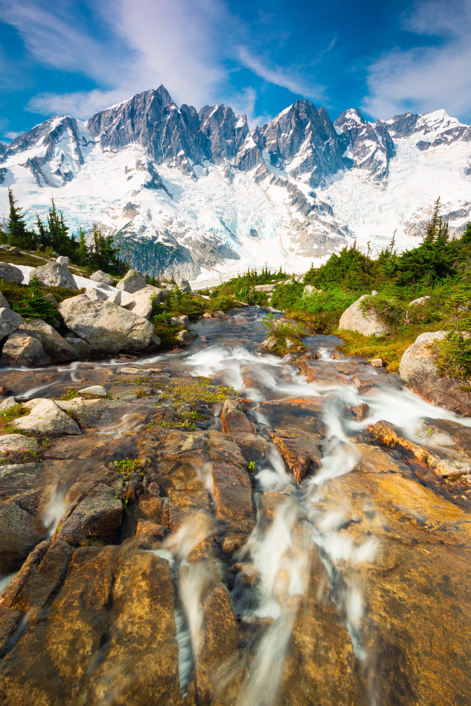
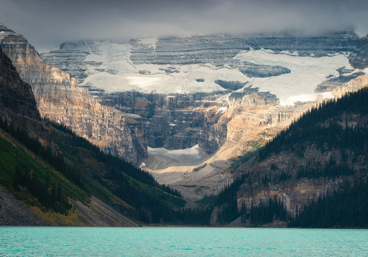
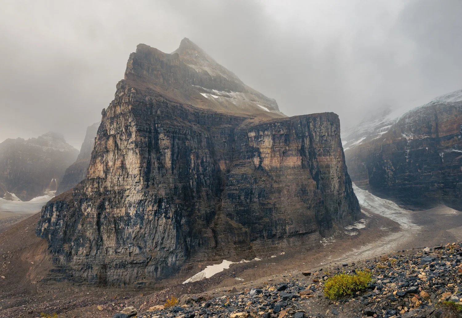
Auyuittuq is centered around two distinct landscapes: the Penny Ice Cap and Akshayuk Pass. The former is a mass of ice covering most of the park, a remnant from the last ice age. The latter is a deep fjord flanked by colossal peaks on either side. Many of these mountains are named after Norse gods and mythology, including Mount Thor and Mount Asgard, the park’s most famous mountains known for their sheer verticality. Mount Thor, in particular, has an overhanging cliff that forms the tallest uninterrupted vertical drop on the planet, approximately 1,200 m (4,100 ft).

Mount Thor

Weasel River

Hiking the entirety of Akshayuk Pass's nearly 100 kilometers can take 8 to 12 days. However, some of the most notable landmarks—Mount Thor, Mount Asgard, Turner Glacier, Highway Glacier, and Summit Lake—are located in the southern part of the hike, closer to the tiny village of Pangnirtung. For those photographically inclined, a multi-day out-and-back trip from the south to Summit Lake and back may be the best option.

british Columbia
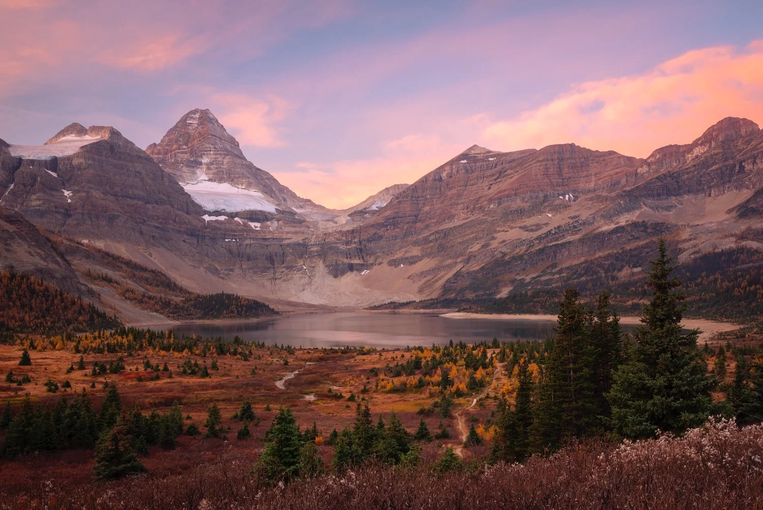
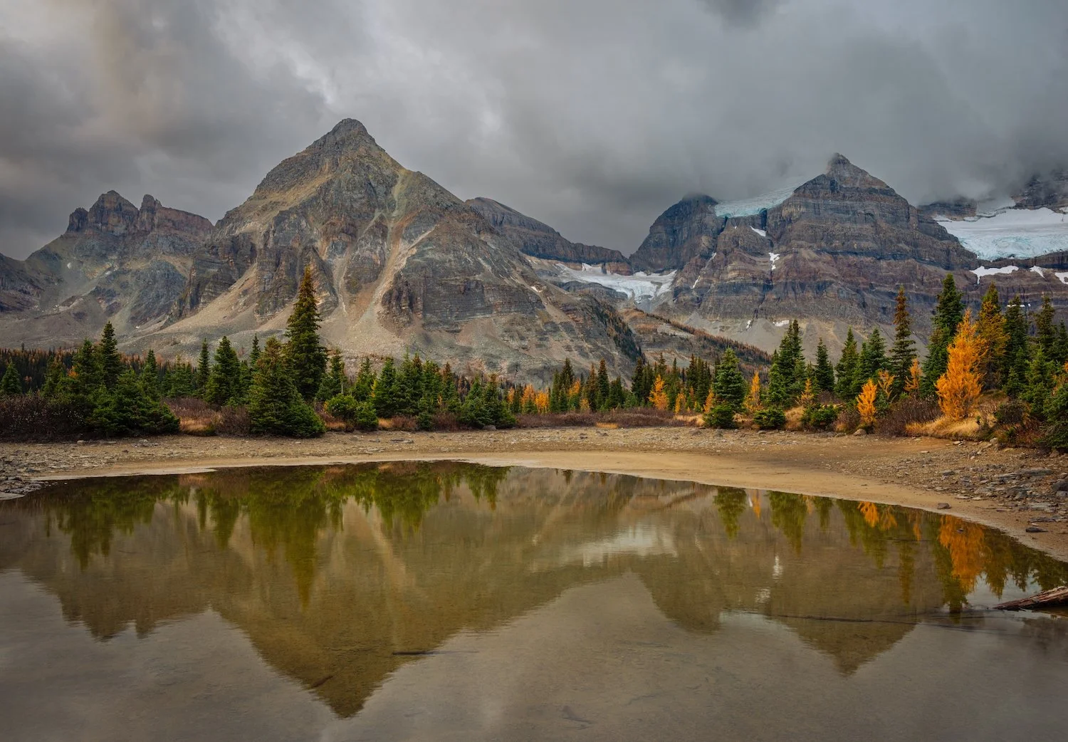
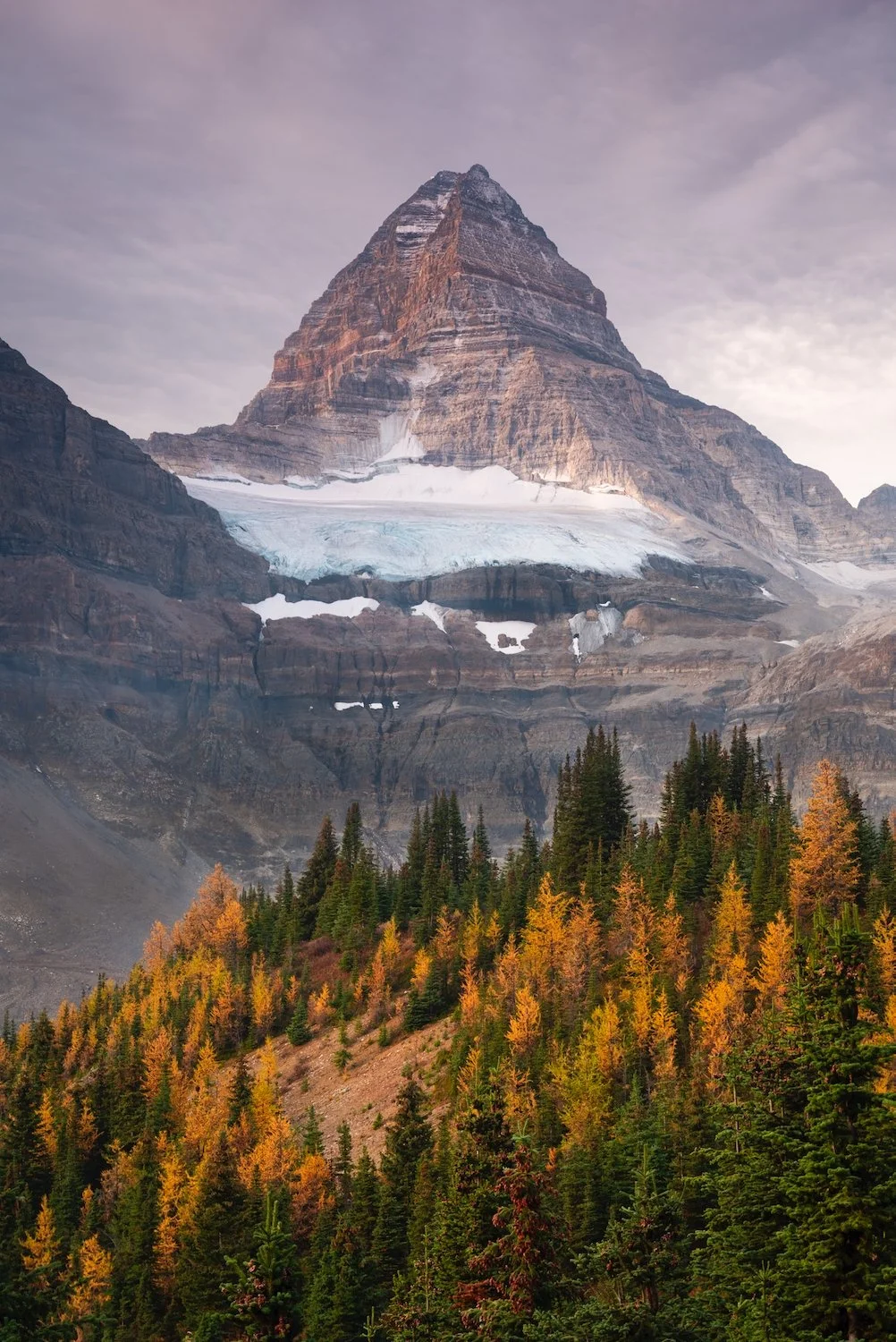
Mount Assiniboine Provincial Park
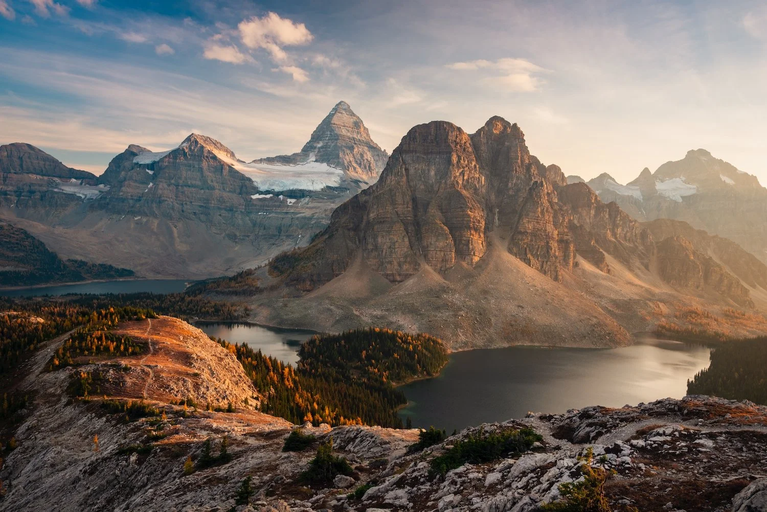
Mount Assiniboine Provincial Park is a wild jewel on the British Columbia–Alberta border, lying approximately 48 km southwest of Banff. Named for its iconic peak, the park is accessible only by a long hike or by helicopter. It is a dramatic tapestry of jagged summits, alpine meadows, and turquoise glacial lakes. At its heart stands Mount Assiniboine, often called the “Matterhorn of the Rockies,” which soars to 3,618 m (11,870 ft) and rises roughly 1,525 m (5,003 ft) above Lake Magog. It is the highest peak in the Southern Continental Ranges of the Canadian Rockies.
Undoubtedly, one of the most epic hikes in the Canadian Rockies is the trek up to Nub Peak, where sweeping views open to Mount Assiniboine, Sunburst Peak, Lake Magog, and Lake Sunburst, with Cloudburst Mountain and the surrounding ranges completing the panorama.
coast mountains
Remote, unspoiled, and enormous, the Coast Range, extending from Alaska through British Columbia, is one of North America’s true wildernesses. Compared to other mountain ranges, there aren’t many trails, especially as you travel north. The pictures below are from the Mount Waddington area, which features spiky peaks and expansive glaciers. Helicoptering into this region is the safest and fastest way to access it.

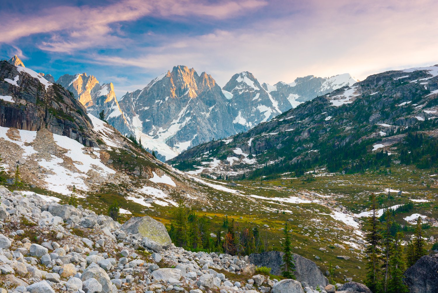

Mount Waddington is the highest peak that lies entirely within British Columbia, and there are a number of sub-peaks and glaciers that surround it. The terrain is harsh and uncompromising. However, the area around Nabob Pass provides access to some of the most dramatic landscapes in the Coast Mountains and British Columbia generally. These mountains receive a lot of snow in the winter because of their position by the coast, which ensures a near-constant stream of precipitation. Here, glaciers and icefields envelop the massive mountains formed over millions of years, and visitors are sure to be awed by the untamed beauty of this part of the world.

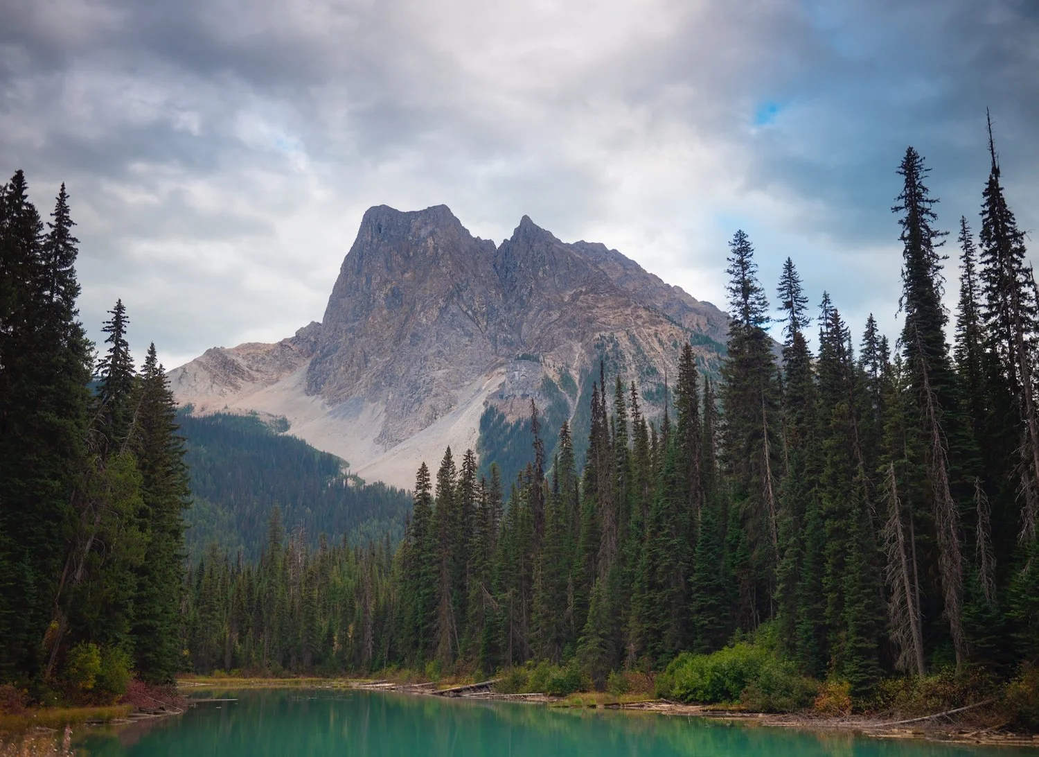
Yoho National Park
Established in 1886, Yoho lies just across the Alberta–British Columbia border along the western slopes of the Canadian Rockies. Its name comes from a Cree expression of awe, fitting for a landscape of towering peaks, plunging waterfalls, and deep glacial valleys. The park is home to some of the Rockies’ most celebrated sights: the turquoise waters of Emerald Lake, the thundering 373-meter Takakkaw Falls, and others.
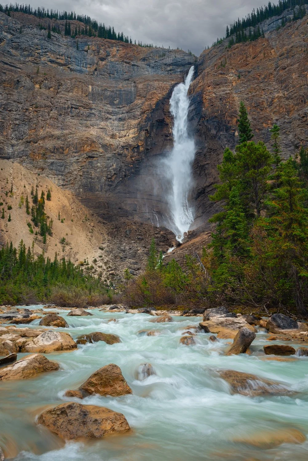
Takakkaw Falls
Alberta
Banff National Park
Banff National Park is Canada’s first national park, established in 1885, and spans about 6,641 km² in Alberta’s Rocky Mountains. Its rugged landscape is a mosaic of soaring peaks, glaciers, dense forests, and crystalline rivers. Within this vast terrain lie some of the Rockies’ most iconic lakes. Moraine Lake, nestled in the Valley of the Ten Peaks, glows a vivid turquoise in summer and is now accessible only by shuttle or guided transport. Closer to the Lake Louise area, trails such as the Plain of Six Glaciers (about 11.4 km return with 595 m of elevation gain) and the Lake Agnes Teahouse route offer classic Rockies hiking with sweeping alpine views.
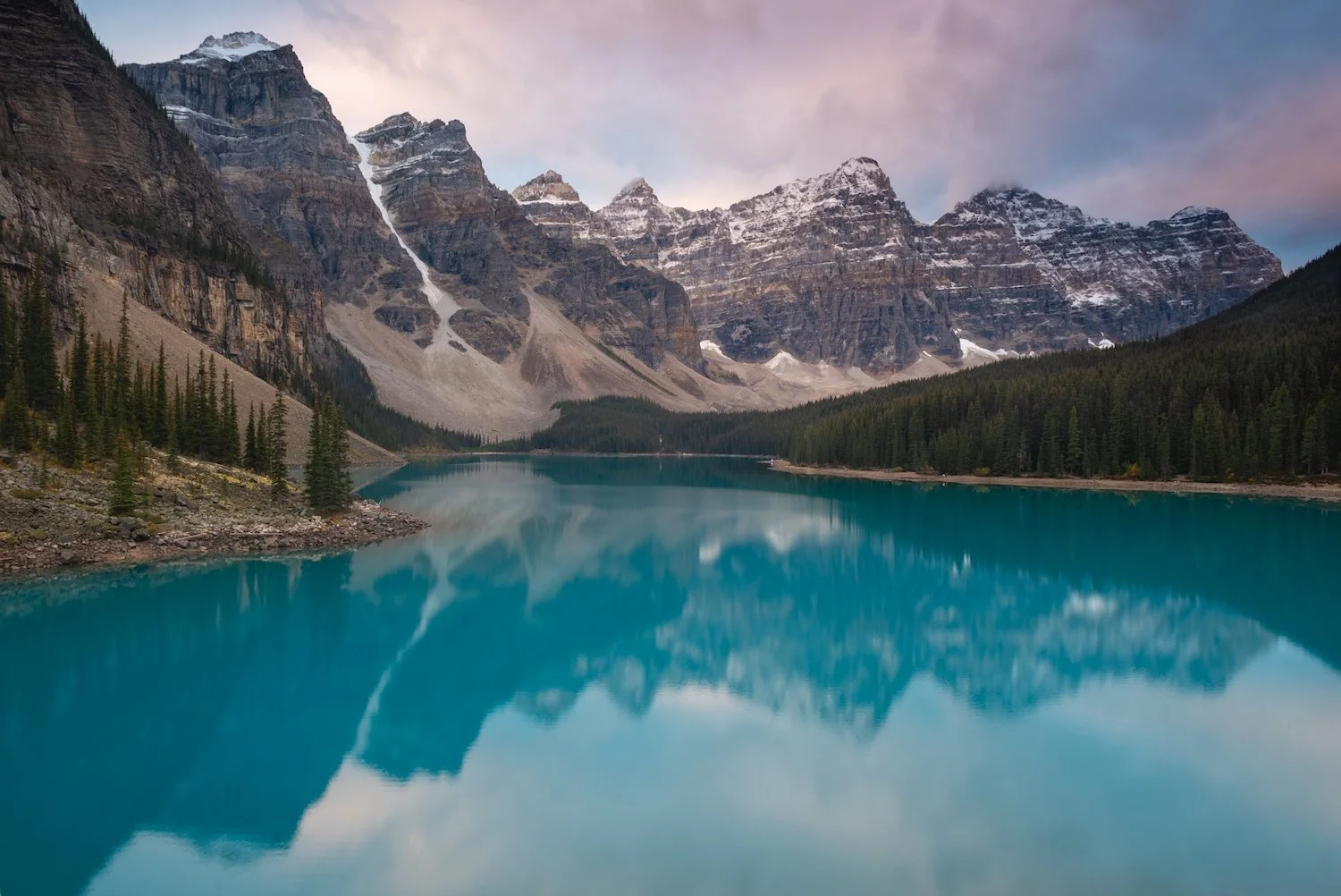
Moraine Lake, Valley of the Ten Peaks
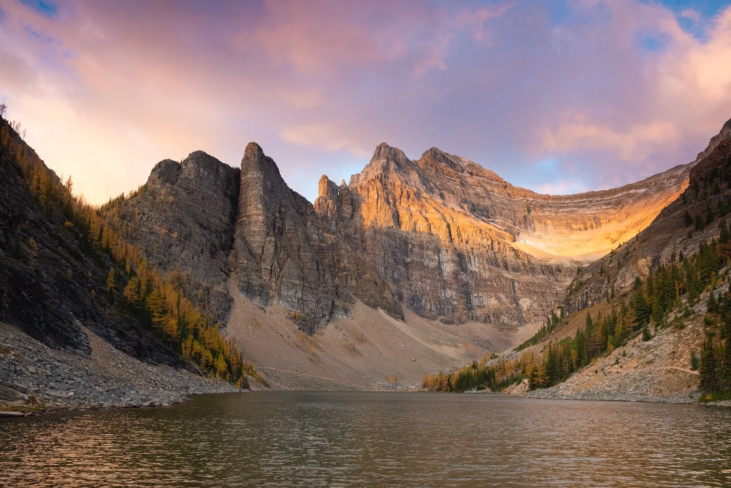
Lake Agnes
Mt Victoria, Mt Lefroy, & Victoria Glacier
Plain of Six Glaciers
Beyond the lakes, Banff is studded with dramatic mountain landmarks. Castle Mountain, Storm Mountain, and the Three Sisters range dominate the skyline near the Bow Valley, while along the Icefields Parkway lies peaceful Herbert Lake, a low-effort gem especially striking at sunrise or sunset. From many vantage points, ranges and glacial ridgelines stretch into the distance, creating a sense of scale and grandeur few places can match in Canada’s national parks.
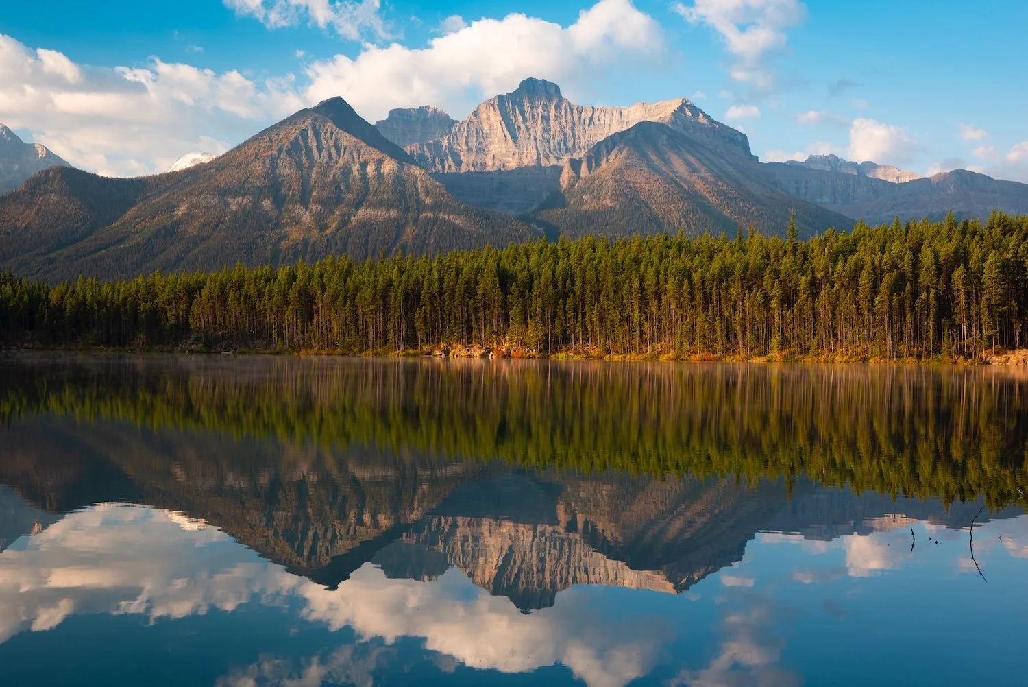
Herbert Lake
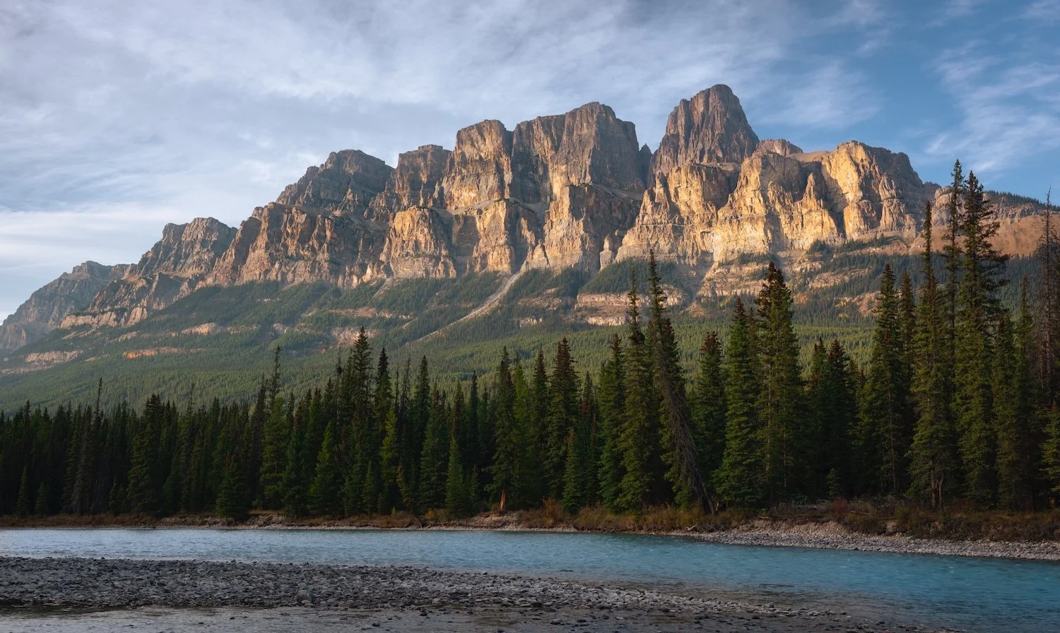
Castle Mountain
Storm Mountain
Three Sisters
Lastly, no trip to Banff feels complete without gazing up at Mount Rundle and nearby Tunnel Mountain, two iconic peaks that frame the townsite and Vermilion Lakes. Rundle’s tilted limestone ridge and Tunnel’s rounded summit catch the light differently throughout the day, making them among the most photographed silhouettes in the Rockies. Though Rundle’s summit hike is demanding and Tunnel’s much gentler, together they stand as unmistakable symbols of Banff’s dramatic landscape.
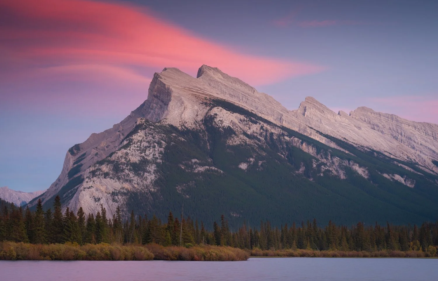
Mount Rundle
Mount Rundle
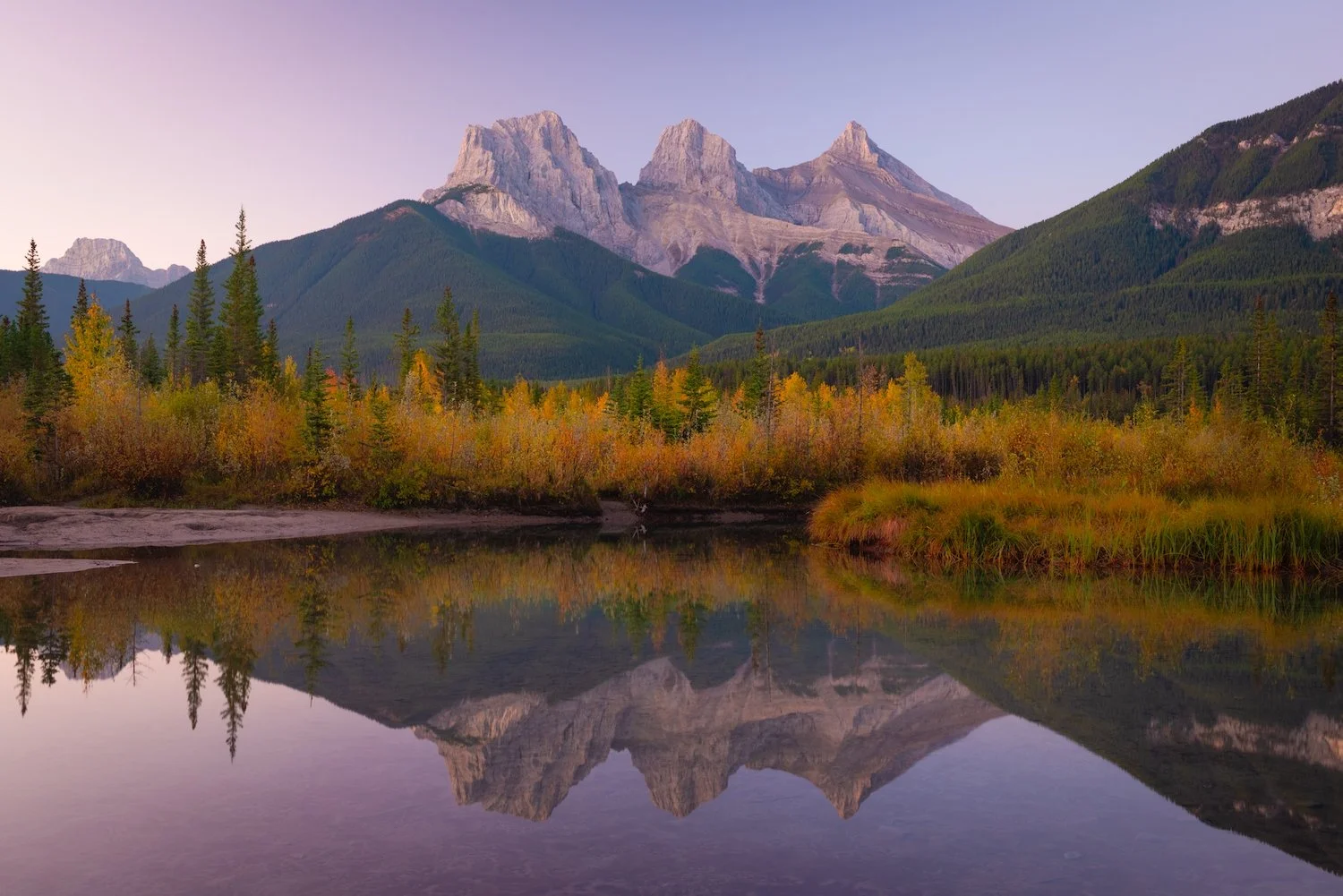
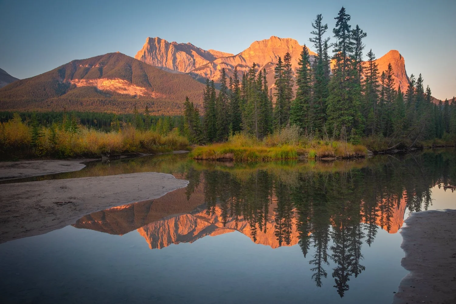
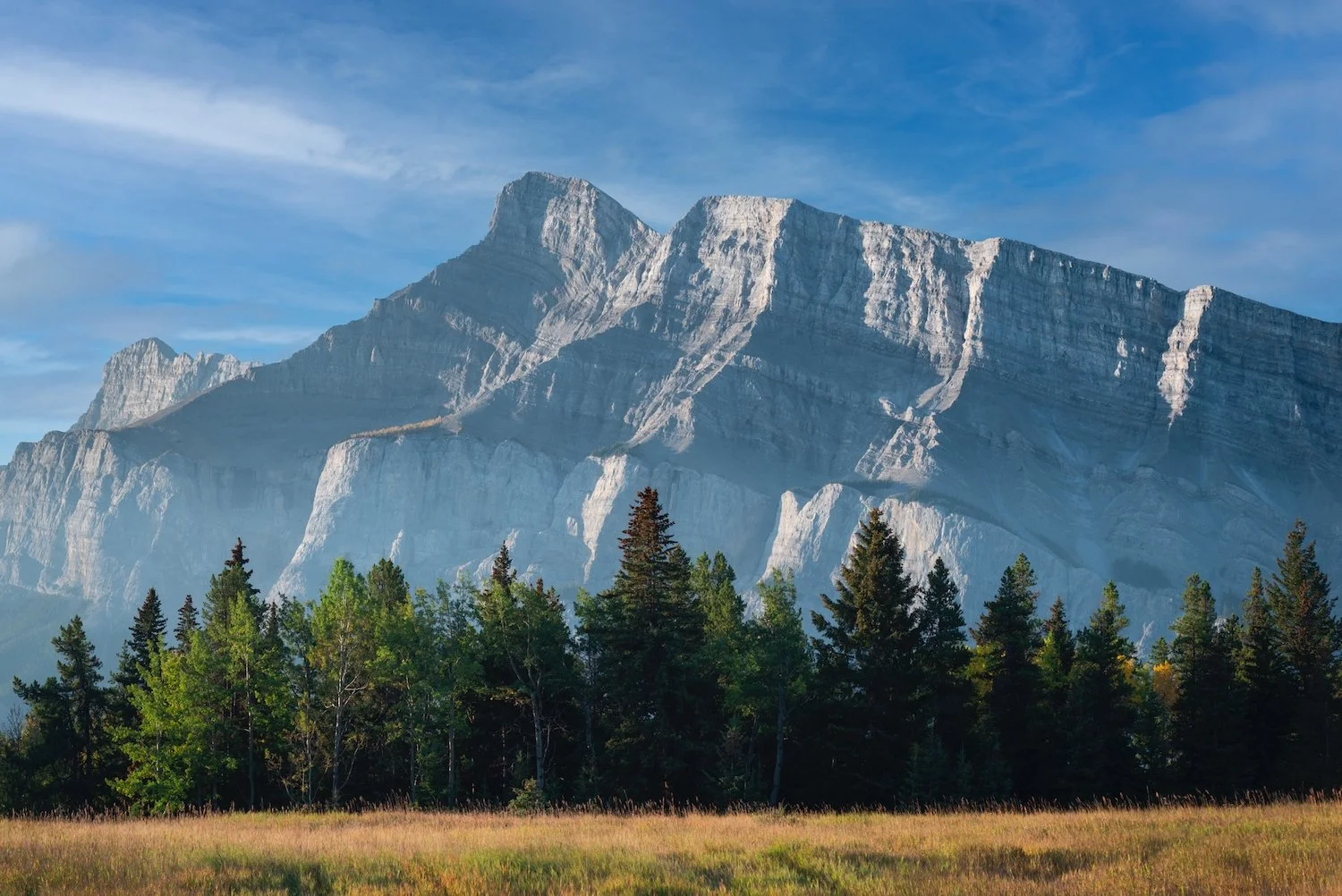
Kananaskis Country
Kananaskis Country, a vast network of parks and wildland areas just south of Banff, offers a quieter alternative to the national parks while still showcasing the grandeur of the Rockies. Its valleys and peaks are laced with trails for hiking, biking, and skiing, and wildlife sightings are common, from bighorn sheep to grizzly bears. Among its most photographed spots is Wedge Pond, a small reflective lake at the base of Mount Kidd that glows with autumn larches and perfectly mirrors the surrounding peaks at sunrise. This blend of accessibility and dramatic scenery has made Kananaskis a favorite for both casual visitors and backcountry adventurers.
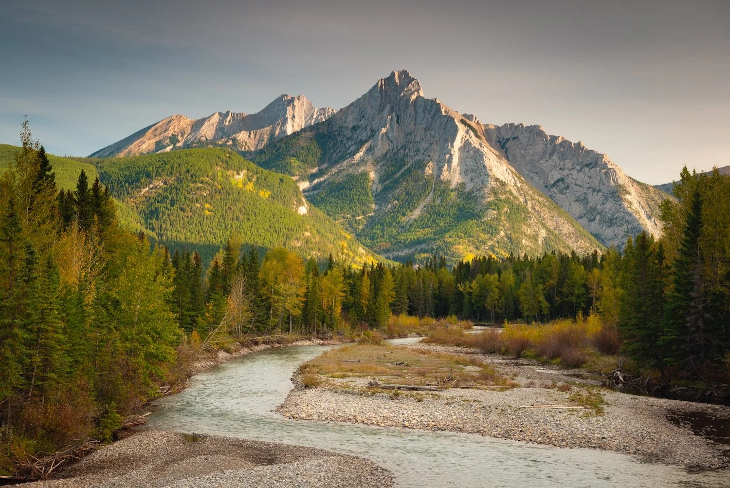
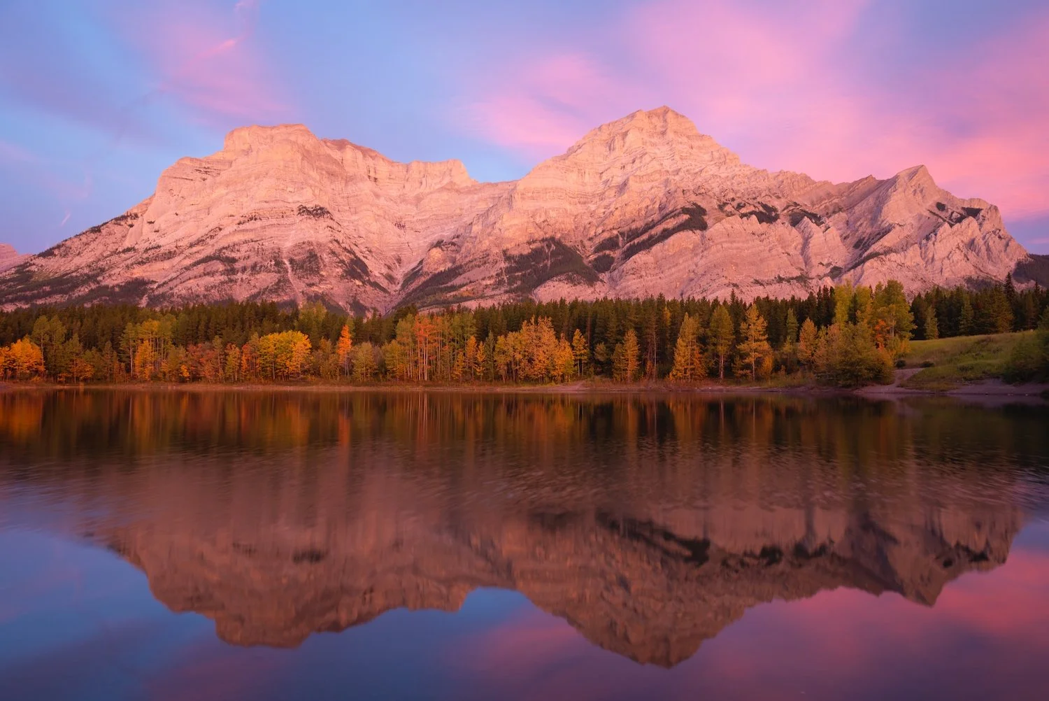
Wedge Pond
yukon
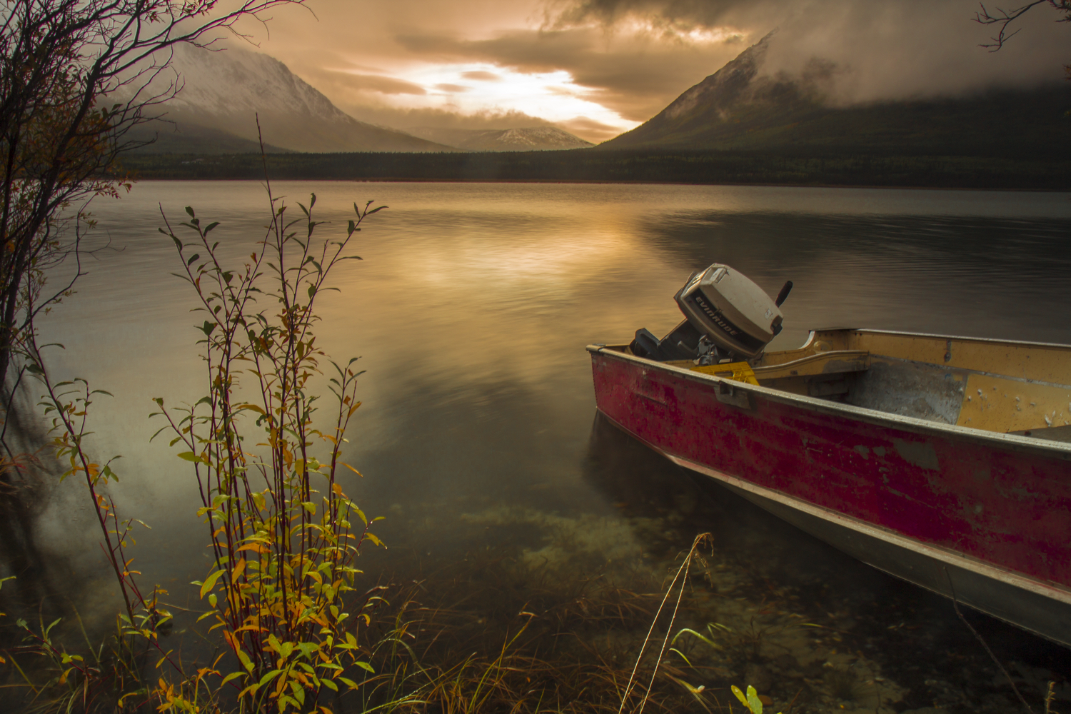
Like Alaska, Yukon is a northern wilderness of endless mountain ranges, forests, and icefields. Because of its sparse population, the territory very much defines the words "wild," "remote," and "unspoiled." Most of Yukon has a subarctic climate, characterized by long cold winters and brief warm summers. Around the Whitehorse area in southern Yukon, evergreen trees grow abundantly, but as you travel north, the shorter and colder growing season allows only treeless tundra to thrive.
Though Yukon blossoms with wonderful wildflowers in the summer, the diverse colors of early autumn make fall my favorite season. The tundra in the north explodes with red and orange hues during this time, making it popular with photographers. Regardless of when one visits, the Canadian territory is a photographic paradise of vast uninhabited expanses, huge towering mountains, colorful foliage, and unrelenting weather. Rain is often likely, but the weather regularly produces some of the most incredibly dramatic and menacing clouds—especially during the golden hours.
Fish Lake/Southern Yukon Highway
Southern Yukon is dotted with beautiful lakes and mountains, all of which are more accessible than other, wilder parts of Yukon. The Yukon Highway weaves its way around this area and provides majestic views and short hikes right from the road. The section of the highway just outside Whitehorse, particularly around Fish Lake, offers a stunning sample of the taiga wilderness that is Yukon (pictures two and four).
Farther east and running near the Mackenzie Mountains in central Yukon is the short but deep Lapie River Canyon, known for its pristine teal water. As the river cuts further into the canyon, the walls begin to grow in height. There are a number of interesting overlooks to view the river below, including this one with small pine trees growing on the banks.


Lapie River Canyon
Dawson and Western Yukon
The road crossing between central Yukon and Alaska is appropriately named the "Top of the World Highway" and traverses high, elevated mountain passes, as its name suggests. From this vantage point, it is absolutely incredible to see the rolling hills, blanketed in colorful fall flora, in front of distant snow-covered peaks. Western Yukon is also home to the mighty Yukon River, which enters from Alaska and ends near the border with British Columbia.

Top of the World Highway

Midnight Dome
Kluane National Park and Reserve
Kluane—home to Canada’s largest mountains—is a land of extremes. This southwest Yukon park contains Canada’s highest peak (the 5,959-meter Mount Logan), its largest ice field, and North America’s most genetically diverse grizzly population. Outside its frozen interior, the park consists of forest and tundra, where the climate is colder and drier than in the western and southern parts of the park.
The park’s interior is generally accessible only via flightseeing tours or on serious mountaineering/ski touring expeditions. The first picture showcases the beauty of the park during peak fall season. The row of mountains in the distance is essentially holding back the sheet of ice that continues far into Alaska.


Slims River