
patagonia
Los glaciares national park
This magnificent park's name refers to the 47 glaciers originating from the Southern Patagonian Ice Field, the largest ice cap outside of Antarctica, Greenland, and Iceland. Of these 47 glaciers, 13 flow directly into the Atlantic Ocean. The park is divided into northern and southern sections. The northern half consists of part of Viedma Lake, the huge Viedma Glacier and a few minor glaciers, and a number of mountains, like Mount Fitz Roy and Cerro Torre, that are very popular among climbers and trekkers. Fitz Roy is perhaps Argentina’s most recognizable peak.
The southern part also has a number of glaciers including three major ones that flow into Argentino Lake: Perito Moreno Glacier, Upsala Glacier, and Spegazzini Glacier. Visitors must take a boat to visit Upsala and Spegazzini, the only way to get up close to their huge faces. Perito Moreno may be the world’s most famous glacier, easily accessible from the town of El Calafate.

Monte Fitz Roy


Perito Moreno National Park
It’s difficult to think of a more iconic glacier than Perito Moreno. This 97 sq. mile behemoth is nearly 20 miles in length and is active, meaning it is experiencing episodes of growth and contraction, but remains at a steady size. The glacier is fed by the Southern Patagonia Ice Field, the world's second largest contiguous extrapolar ice field from the west, in Chile. To sit and watch massive blocks of ice calve off if its face, thundering down to the lake to their demise is an unforgettable experience. You can both hear and feel the power of nature in these consistent and frequent calving events.
The wall of the glacier is more than three miles wide and it can reach heights of 240 feet above the water and nearly 600 feet below. On a cloudy day, the deep blue of the glacier, along with streaks of debris that the glacier carved from the land make for an amazing sight. Tall mountains hug the glacier, forcing its icy mass through the submerged fjord. It terminates at Lago Argentino, the biggest freshwater lake in Argentina.

Perito Moreno Glacier
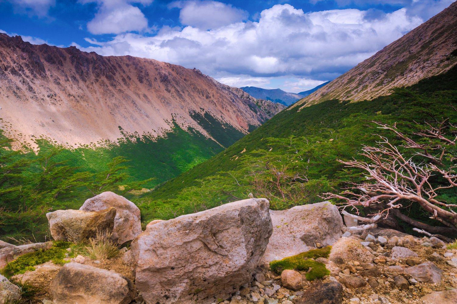
Nahuel Huapi National Park
Nahuel Huapi National Park - Argentina’s oldest national park and Bariloche’s gateway to the Andes. Blessed with its huge, expansive views, the park is truly a national wonder. As its name implies, It primarily protects the huge Nahuel Huapi Lake all the peaks and forests that surround its shores. The lake itself is the speculated home of “Nahuelito,” a mythical lake monster similar to the Loch Ness Monster that dates back to the indigenous inhabitants that first occupied the area.
Around the park several trails cross into the mountains, including, perhaps the most popular, the climb up to Refugio Frey. This six-mile hike ends at the Refugio, which offers hiker’s accommodation and a gorgeous view of Laguna Toncek. Several other hikes originating from Bariloche and elsewhere, lead to stunning waterfalls, lakes, and mountain peaks.
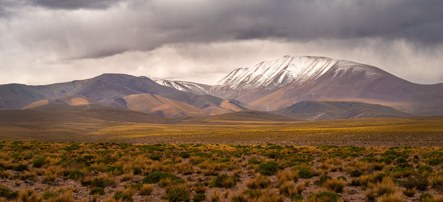
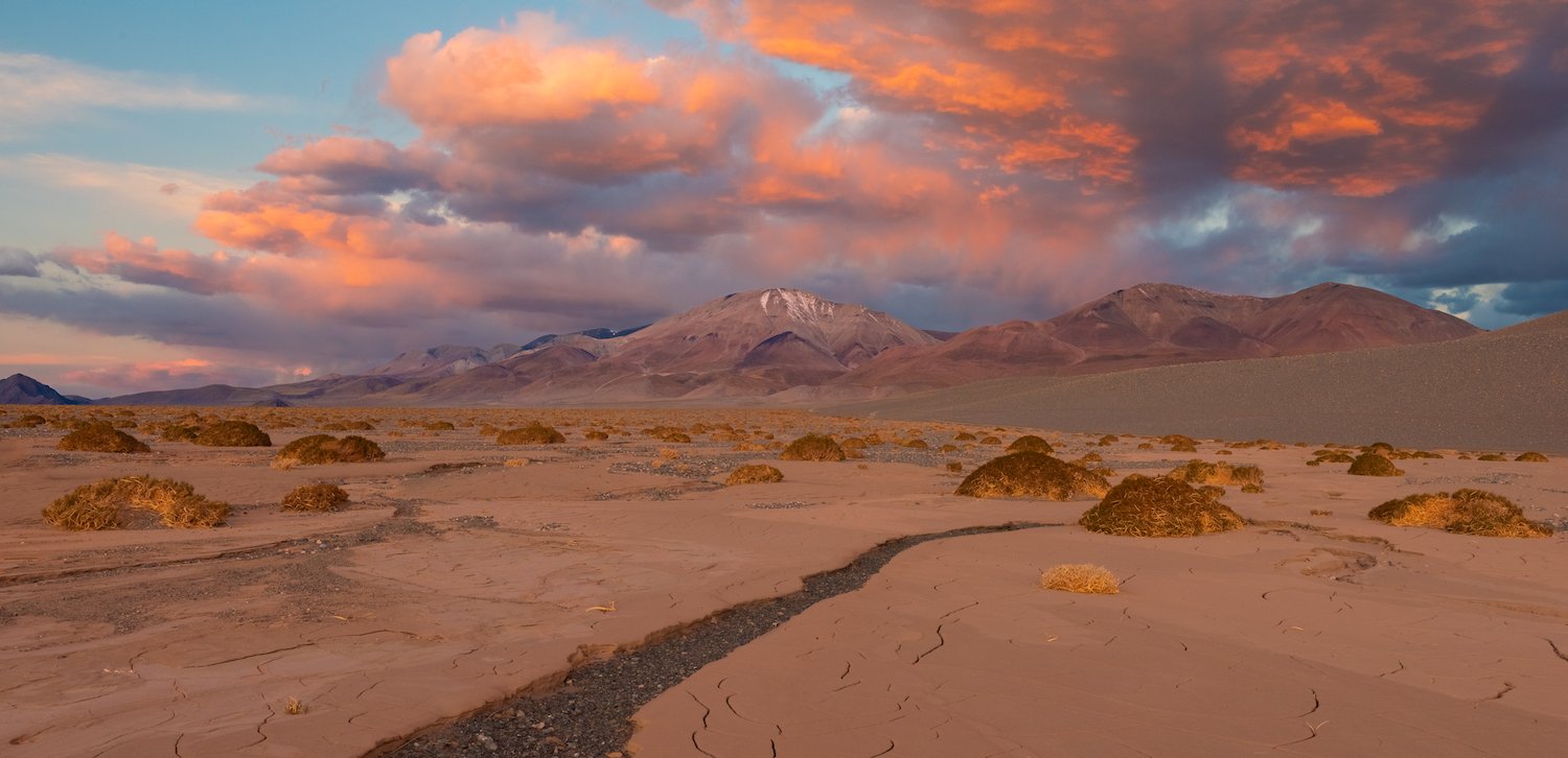
puna de atacama
The Puna is a high plateau region of northwest Argentina that borders the Bolivian Altiplano to the north. It shares many of the same geological characteristics of its northern neighbor, including, massive volcanoes, salt flats, colorful lagoons, and eroded rock formations. The following are some highlights from the region.
Cerro Laguna Blanca
El Peñón
El Peñón in Catamarca Province is a fantastic lauching point for exploring the southern Puna. This small village is provides access to the Pumice Stone Field (profiled below) and is also surrounded by salt flats, volcanoes, and other amazing high desert environments worth mentioning.
Just outside the town are wonderful views of the surrounding peaks coupled by dry, cracked surfaces. To the east, Cerro Laguna Blanca (or Nevada Laguna Blanca) towers imposingly in the distance. To the west, is Laguna Carachi Pampa, a wonderfully colorful lake with a resident flamingo population. In the direction of the pumice field exist captivating white mountains that draw one into the beautiful of this alien land.


Laguna Carachi Pampa

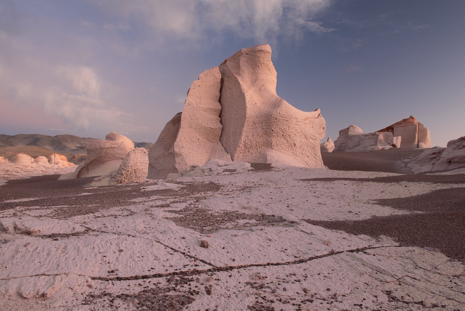
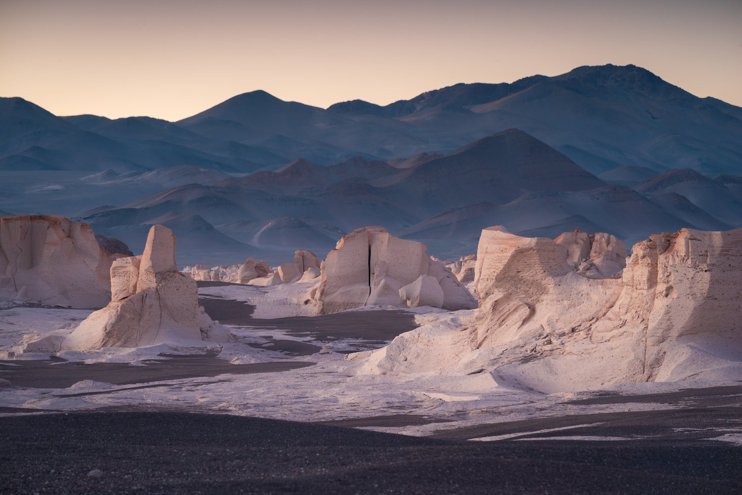
Pumice stone field
Otherwise known as Campo de Piedra Pomez in Spanish, the Pumice Stone Field is unquestionably one of the major highlights in the Puna. This Martian landscape is truly a photographer’s paradise. Monumental pumice stones created by a volcanic eruption and carved by the erosive power of the wind are contorted into wonderful sculptures. These white stones vary greatly in size and height, but most are above 10 feet. All contain bright white colors and some, a hint of brown.
The field itself is very expansive and one is unable to see the end from most angles. That, coupled with the fact that the area around is extremely remote, makes visiting this amazing place a surreal experience.


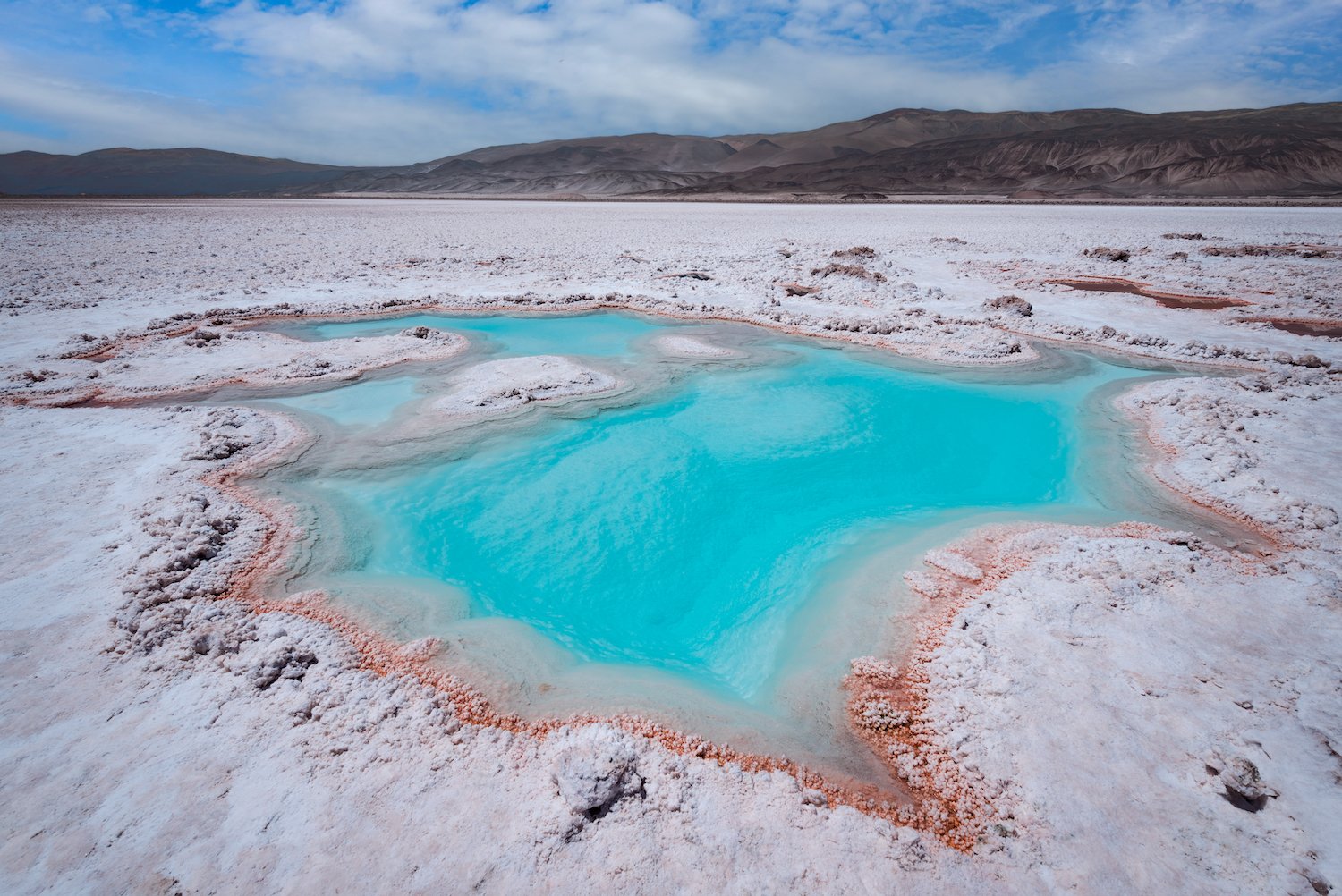
Laguna Verde and Salar de Antofalla
Not to be confused with the famous Laguna Verde in southern Bolivia, Argentina’s Laguna Verde isn’t one body of water but several ponds, many of which contain distinct colors. It’s located on the western edge of the Salar de Antofalla – an expansive salt flat hugged by mountains. A 4x4 dirt road runs along the west of the Salar, crossing colorful landscapes that contain unique desert characteristics. The laguna itself is best photographed either on land with a wide-angle lens or from above via drone.


Los Colorados/Desierto del Diablo
East of the tiny rural village of Tolar Grande in Salta Province is an incredible park of little notoriety to those outside of Argentina. Los Colorados contains majestic orange and red badlands that are so beautifully eroded by the power of wind and rain that the landscape itself looks nearly artificial.
An area near the center of the park named the “Desierto del Diablo,” named surely due to the color of the land, is a highlight with small peaks surrounding a small valley.

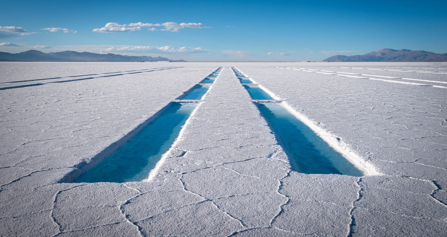
Salinas Grandes
The Salinas Grandes salt flats are a popular attraction due to their proximity to the tourist town of Purmamarca. Similar to the more famous Salar de Uyuni in Bolivia, this white landscape contains hexagonal formations formed by crystallization and evaporates following a flooding event. If the salar is flooded, the landscapes appears like a huge mirror, reflecting the clouds above.
Perhaps Salinas Grandes best known for the various crystallization pools built by the local salt harvesters. These pools, are only a feet wide and long each. The salt is left to “mature” through evaporation, after which the salt is removed and piled to side, leaving it to dry.

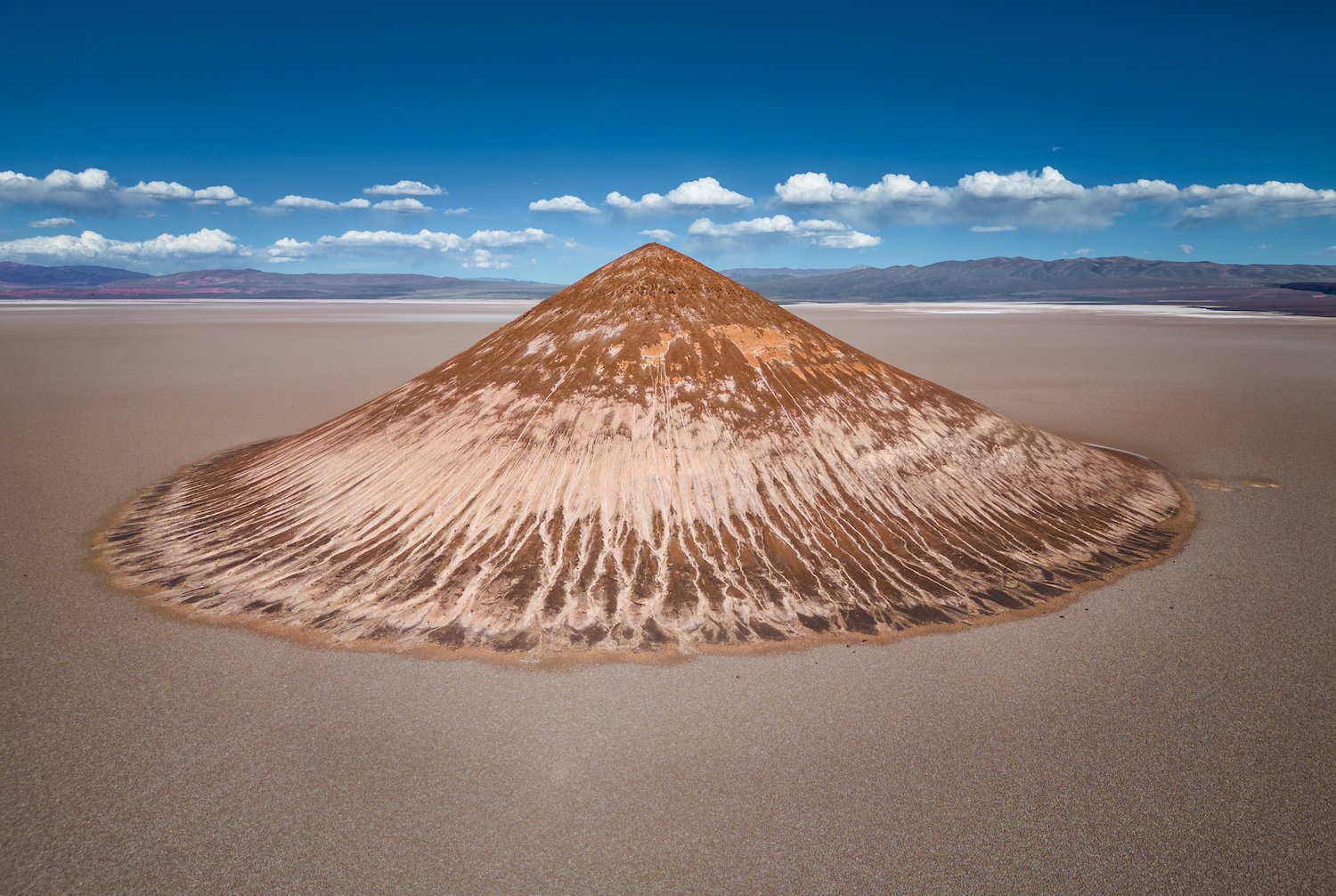
Cono de Arita
Due mainly to its sheer eccentricity and strangeness, the Cono de Arita (or Arita Cone) is one of my favorite formations in the Argentina Puna. This massive cone is found on the southern end of the Salar de Arizaro, one of the largest salt flats in the world.
The cone is approximately 122 meters tall and surrounded by a dry expanse of salt and other properties. It is believed to be an extinct volcano that never erupted. It therefore lacks a crater and evidence of lava flow. The Incas considered the formation sacred and its impressive size relative to its surroundings leaves no doubt why.
Calchaquí Valleys
The Calchaquí Valleys (Valles Calchaquíes) are a series of valleys that connect the lush green lowlands of the east to the high desert plateau of the west in northwest Argentina. These valleys form elevation transition zones before reaching the heights of the Puna and vary greatly in character.
For example, the verdant Cuesta del Obispo, which originates west of Salta, offers stunning views throughout its length as the road through it weaves its way up the mountainside. Pastoral scenes, including gauchos herding cattle, are a common sight. The Cachi Valley is similarly green and home to indigenous communities that tend to the land. The valley terminates at the Nevado de Cachi mountains, some of the highest in the region.

Cuesta del Obispo

Cachi Valley
Though more barren, Quebrada de las Flechas is definitely one of the most photogenic landmarks of the region. Travelers between Cachi and Cafayate on Argentina’s famous Route 40 are rewarded with passage through a bizarre landscape of giant rocks, often tilted in seemingly gravity-suspending ways. A number of highway pull-offs offer short hikes to panoramic vistas of the vertical walls below.
My favorite of the valleys, however, is Quebrada de las Conchas (Shells’ Ravine), a park formed by the erosive power of wind, rain, and the river that runs through its center. Americans will find plenty of similarities to parks in Utah, particularly Arches National Park, based on the red rock and monumental rock formations.

Quebrada de las Flechas

Quebrada de las Conchas
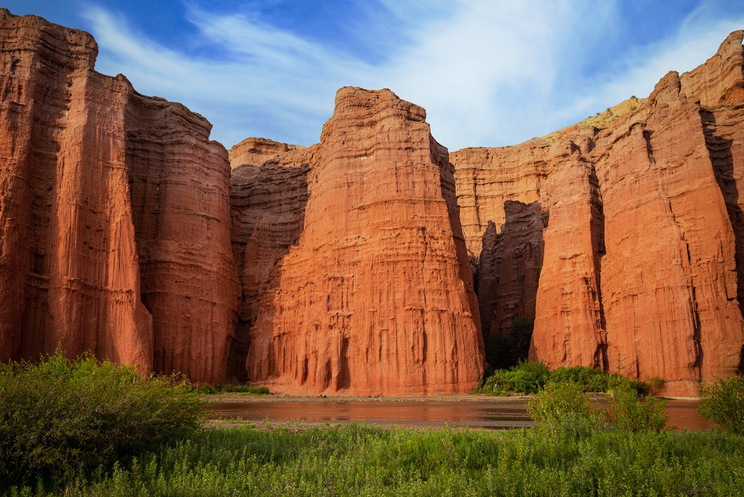
Quebrada de las Conchas

Quebrada de las Conchas
Los Cardones National Park
Los Cardones National Park lies west of Salta before approaching the Calchaquí Valleys further on. This park protects several multicolored mountains and surrounding arid lands. However, it is probably best known for its collection of “cardon grande cactus” or Argentine saguaro. At maximum height, these trees can grow to nearly 30 feet and are impressively large.
Less celebrated are the wonderful badlands scattered throughout the park. I found these landscapes most compelling, particularly from the view pictured here.

Purmamarca
Purmamarca - one of the most scenic small villages in all of northwestern Argentina. Located in Jujuy Province’s Quebrada de Humahuaca, it boasts a beautiful combination of traditional colonial architecture and surrounding natural beauty. Indeed, it sits at the foothills of the Cerro de Siete Colores or Mountain of Seven Colors, a beautiful multicolored natural formation that serves as a wonderful backdrop to this small town.
The mountain is best photographed in the morning as the early day rays climb over the hills to the east. There is a short, informal trail across the major road that climbs up to offer a vista that is a perfect way to begin the day.
