
coastline
Julia Pfeiffer Burns State Park (Big Sur)
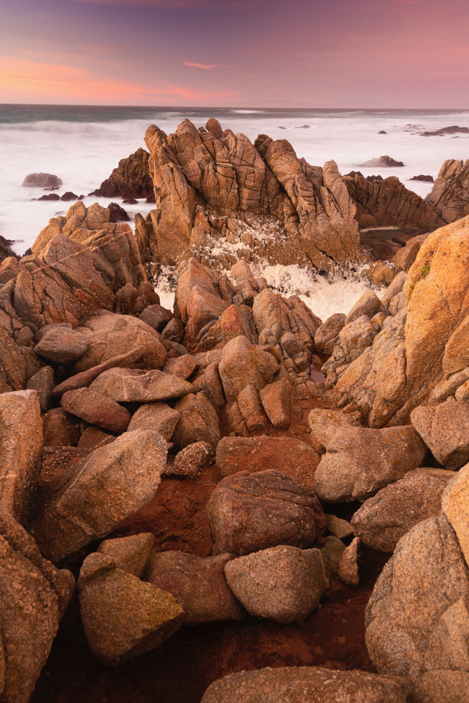
The California coastline alternates between sandy beaches and dramatic rocky cliffs throughout its 840-mile length. However, few sections can rival the stunning beauty of Big Sur with its prominent headlands, monumental sea stacks, and vertical mountains rising nearly directly from the ocean. Pacific Coast Highway (or Highway 1) travels along the coast and is a true engineering marvel, hugging the hillsides near the occasional precarious drop. If driving from the south, Julia Pfeiffer Burns State Park is one of the major parks motorists encounter first with classic Big Sur scenery. Gigantic sea stacks, isolated from the nearby cliffs, direct the tide as it makes its way inland. There are many rest stops, each with incredible, and often elevated, views of the beaches below.


Garrapata State park and Monterey peninsula (big sur)
The northern section of Big Sur contains some of the most recognizable and visited sections of California’s coast, including Garrapata State Park. The park is accessed a few miles south of the charming town of Carmel and contains miles of coastal hiking. From a landscape photography perspective, one can’t do much better than Soberanes Point, a series of cliffs with stunning views the eroded coast. North of Carmel is the Monterey Peninsula, the location of world famous Pebble Beach along with the wild, scenic beaches along 17-Mile Drive.

Soberanes Point, Garrapata State Park

Soberanes Point, Garrapata State Park
Monterrey Peninsula
Mendocino headlands state park
The vast stretch of coastline between San Francisco and the Lost Coast of far northern California shares characteristics similar to those found in Big Sur - tall cliffs, rocky coastline, and sea stacks of every shape and size. As beautiful as the California coast is, Mendocino Headlands State Park definitely stands out as a highlight. As its name implies the peninsula is a series of headlands that meet the ocean along steep cliffs. The ocean water rushes in and between the towering rocks, churning its way around, and making for amazing long-exposure photographs.


Bowling ball beach & salt point state park
Two other notable beaches along California’s coast must be mentioned. The first, Bowling Ball Beach, near Point Arena in Schooner Gulch State Beach, is know for the nearly perfectly rounded rocks situated on the beach. The balls are similar to the Moeraki Boulder and Koutu Boulders in New Zealand and are only revealed at low tide. Salt Point State Park, on the other hand, is similar to the rocky cliffside landscapes of Big Sur.

Bowling Ball Beach

Salt Point State Park
deserts
Death Valley national park
America’s most surreal desert park, Death Valley can also claim the record for hottest temperature ever recorded (134 °F or 56.7 °C) and the lowest point in North America (282 feet [86 m] below sea level) at Badwater Basin. During the winter rains, the Basin temporarily floods. After the water evaporates, it leaves behind high concentrations of salt arranged in a beautiful crust of hexagonal shapes. In the distance the snow-capped Telescope Peak and the Panamint Range rise to 11,049 feet (3,368 meters). Nearby Cottonball Basin and Devil’s Golf Course provide other extraordinary example of how water evaporation and salt combine to alter the land in bizarre fashion.

Badwater Basin

Cottonball Basin

Devil’s Golf Course

In addition to the salt flats, Death Valley is home to a number of multicolored badlands, the most famous being Zabriskie Point. This erosive, undulating landscape of gullies and mud hills at the edge of the Black Mountains, leads to the white salt flats in the main valley and mountains beyond. It is one of Death Valley’s most iconic locations along with the Racetrack Playa, a scenic dry lake filled with polygon-shaped mud cracks. The Racetrack is most famous for its mysterious “sailing stones” - rocks found on the playa floor with long trails behind them. When the Playa freezes in the winter, a thin layer of ice pushes these rocks across the playa, cutting a furrow in the sediment as they move and inscribing linear "racetrack" imprints.

Zabriskie Point

Racetrack Playa
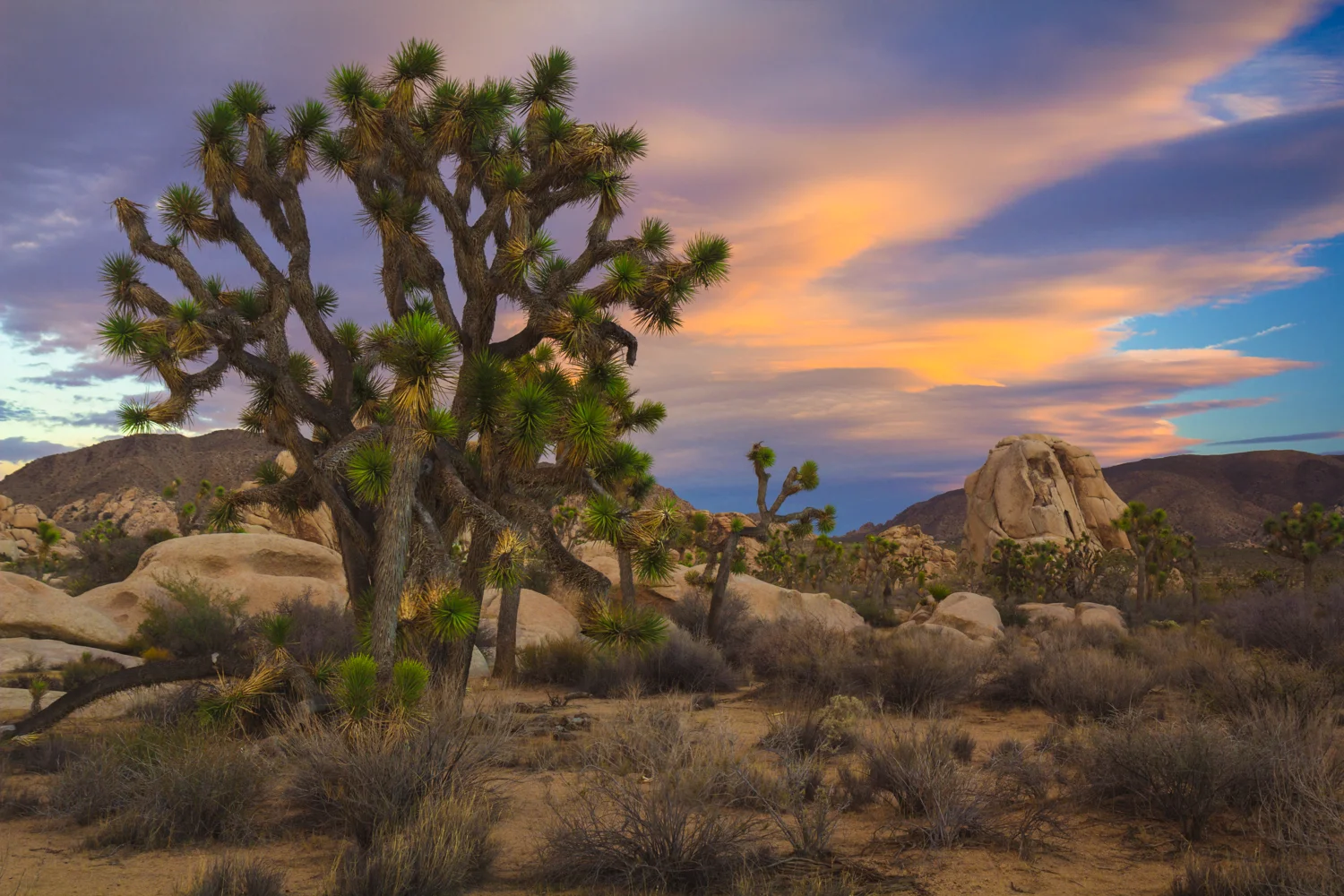
Mojave Desert & Joshua tree national park
The great Mojave is the driest desert in North America and its boundaries are generally noted by the presence of Joshua trees. It’s most famous park, Joshua Tree National Park, as well as the neighboring Mojave National Preserve, contain great concentrations of these alien-looking specimens. Despite being a desert park, Joshua Tree is also home to diverse plant species, most notably the spiky yucca plant and prickly cholla cactus. Bordering the desert in the north, are the strange Trona Pinnacles an unusual geological feature of tufa spires surrounded by many square miles of flat, dried mud and with stark mountain ranges at either side.
Joshua Trees

Yucca Plant in Joshua Tree

Cholla Cactus Garden

Trona Pinnacles
Salton Sea & Anza-Borrego Desert State Park
The Salton Sea is a shallow, highly salinated lake accidentally created when an effort to redirect the Colorado River to increase water for farms led to massive flooding. The lake has been slowly evaporating and the fish and trees that once grew here are slowly dying. Anza-Borrego Desert State Park is a massive, sprawling park of arid mountains, slot canyon, and badlands, like the Font’s Point overlook. If enough rain has fallen in the previous winter, the park explodes in color during the annual desert bloom of wildflowers.


Salton Sea

Font’s Point
forest
Redwood national and state parks
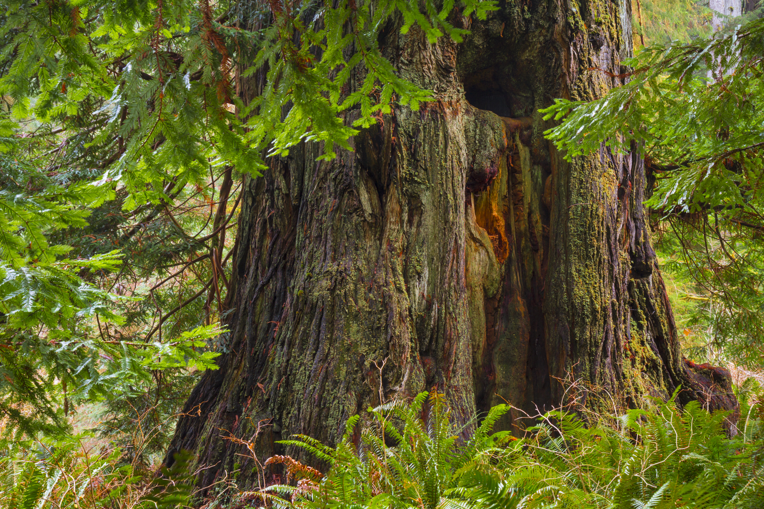
Redwood National and State Parks are a complex of several old-growth forest parks located along the far northern California coast. They comprise Redwood National Park, and California's Jedediah Smith Redwoods, Del Norte Coast Redwoods, and Prairie Creek Redwoods State Parks, which together protect 45% of all remaining coast redwood. Because they are so far north, these four parks receive more rainfall and morning fog than other redwood parks further south near San Francisco, allowing the trees to reach maximum height and circumference. The redwoods here are the tallest, and among the oldest and largest in the world. The jungle environment of Jedediah Smith Redwoods State Park, in particular, produces several record-setting tree sizes, including the great Grove of Titans and Stout Grove. For a full report on these redwood parks please check out my Guide to the California Redwoods.

Grove of Titans

Stout Grove


Though not officially part of the Redwood National and State Parks network, Humboldt Redwoods is similarly characterized by the incredible giant trees and old growth redwood forest of those parks. Its location farther south and in a relatively more arid environment gives the forest a more open and less jungle-like appearance. As such, its trees are more visible and sightlines are clearer. From a landscape perspective, this park is the most scenic and photogenic as the breadth of its forests can be fully appreciated.